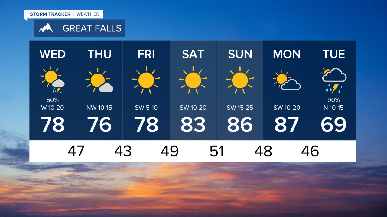
Cooler and wetter conditions settle into the region Wednesday as a cold front passes through Montana. Grab that rainjacket layer just in case!
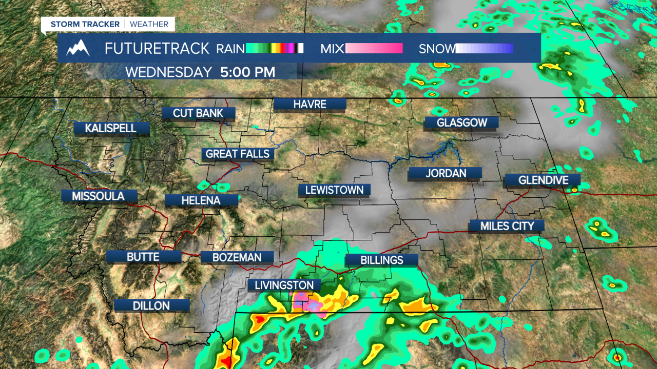
We're waking up to some light precipitation in central Montana with showers moving towards Lewistown and Havre around 6AM. By the early afternoon, these sprinkles will windle out in central Montana. A chance of an isolated t-storm is a possibility throughout the day, although the highest likelihood of active weather will be further south.
Around 2PM, we will start to see the development of a stronger system in southern Montana towards Livingston and Billings. Through the evening a storm will drop 0.25 to 1 inch of rain while the rest of the state remains fairly dry.
Around midnight, this system will push towards southeastern Montana and we wake up tomorrow to drier and cooler conditions in the Treasure State. High temps will sit in the low to mid-70s through Thursday.
This "cooldown" is quickly disrupted by a ridge of high pressure that will warm us back into upper 70s and mid-80s Friday through Sunday. We'll have plenty of sunshine this weekend.