


MONARCH — The stunning scenery of the Dry Fork Corridor in the Helena Lewis and Clark National Forest is an indication of what’s below ground.
Montana's mining boom during the late 19th and early 20th century led to extensive mining in this area, but although the days of active mining are long gone, the impacts are still felt today.
“Geology here dictated that there were a lot of different ore bodies here in this area, predominately silver and lead. So because of that there were a lot of different mining companies that operated here in the past and you know, left their mark on the land," Steve Opp, Minerals and Geology Program Manager for the Helena Lewis and Clark National Forest, told MTN News.
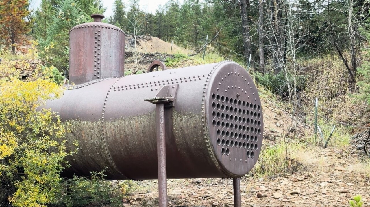
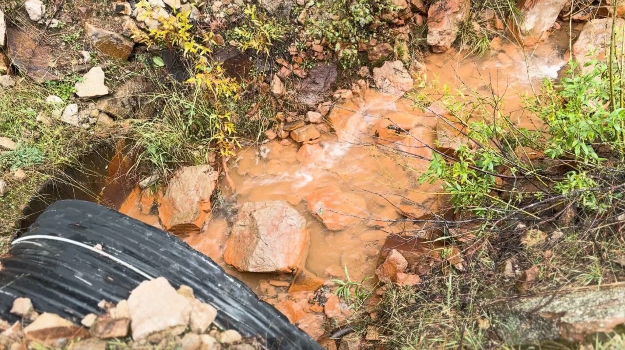
Old machinery and gated-off entrances are clear indications that an abandoned mine is nearby, but a pile of tailings or a copper-colored creek might be less obvious to the untrained eye.
“Galena Creek which is just up here flows red because of acid mine drainage or mine-influenced water," Opp said.
Some evidence of historic mining can only be measured with sophisticated technology.
“Because of the pandemic, we saw an exponential increase in recreational use here," Opp said, "and in 2020, we went around to a lot of the different dispersed sites throughout the drainage where people are camping and took a portable what they call an x-ray fractometer, an XRF, and measured metals levels in the soils at these camping areas, and found that there were areas that we had people camping on areas with elevated metals.”
Health impacts from abandoned mines still pose a risk to human and environmental health.
According to the EPA, soil, sediment, groundwater and surface water near the Barker-Hughesville mining area has been contaminated with arsenic and metals such as copper, zinc, cadmium and lead.
Chemicals were once used to refine the precious metals found underground. Over time, flooding and rain events transmit these contaminants down the watershed.
“That's what we're seeing down here is the fluvial tailings that have come down the drainage through flooding events," Opp explained.
As the EPA facilitates remediation on this Superfund site, the Forest Service and other agencies åre taking measures to protect people hiking and camping in the area.
“[We've been able to] set up vault toilets, to set up fire rings and pull people out of areas that we know have impacts and try and encourage them to go to areas that we know were clean outside the floodplain," Opp said.
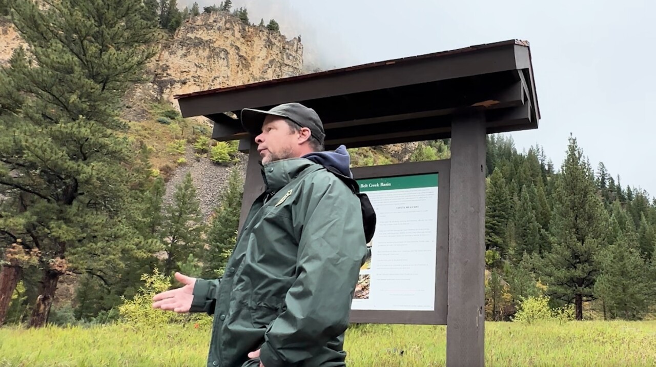
Newly installed kiosks outline safety measures like bringing your own filtered water, washing your hands before you eat to avoid ingesting any dust or soil, and staying on trail.
For more information on this site, click here.
