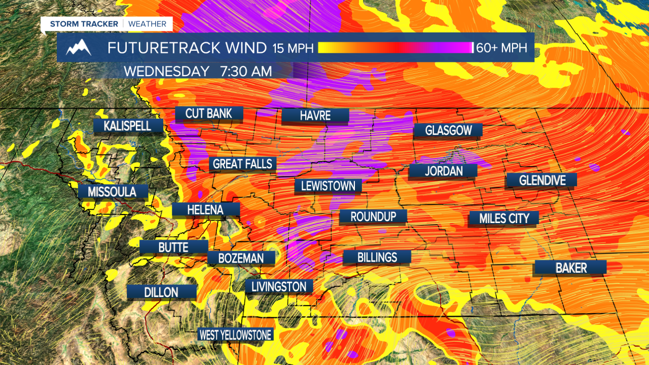
The true power and landscape changing capability was once again on full display yesterday as a rapid rise in water levels set the dominoes in motion. Flash flooding along with debris tore through Yellowstone National Park, wrecking enough havoc that the National Park Service opted to close all entrances to the park indefinitely. Effects from this flooding were seen in many other areas as well, one of which was Red Lodge, where a white rapid style stream was caught on video racing through the center of town. A powerful storm is currently bringing snow to areas on the Continental Divide, with the heaviest snowfall currently being situated over the Northern Rocky Mountain Front. High winds will be present along mostly all of the high line and more of the state will feel high winds than those who won't. For that reason, the National Weather Service has expanded the HIGH WIND WARNING that was in effect for a few areas in north-central Montana yesterday. A WINTER STORM WARNING is in effect for higher elevations in northwestern Montana, mainly the Northern Rocky Mountain Front. A WINTER STORM WATCH is also in effect for more surrounding areas in northwestern Montana. A FLOOD WARNING remains in place for areas in south Montana including Yellowstone, Red Lodge, and Gallatin. As we move through the week, temperatures will begin significantly increasing Wednesday, eventually seeing multiple areas topping the century mark on Friday. With such a rapid increase in temperature, mountains will quickly melt away a large portion of snow, which will make it's way into our rivers, lakes, and streams far more quickly than normal. This, along with potentially severe thunderstorms and heavy rain will act to even further increase the flooding which is ongoing around Montana. Please be vigilant moving forward over the next week or more as rushing water on roadways is becoming more likely and common with so much flooding around the state. It may sound funny and cliche after being used so often in the meteorology community, but, TURN AROUND DON'T DROWN absolutely applies right here in the treasure state. On a mundane normal day drivers can usually not accurately tell how deep rushing water is across a road; this flooding event in Montana will make situations like this even more treacherous due to the amount of debris being carried and the wild amount of water that is currently displaced. It may take a bit for some of the mountain released water to make it's way down into places like the Missouri River following our 100 degree day Friday; so it may be easy to write the flooding danger off as a miss for your area. Please don't let this fool you as once that particular moisture starts hitting the Missouri, we may see rapidly rising water levels and displacement continue without breaks for days on end. All the water will work downstream, and for southern parts of the state who saw such devastation from Monday's flooding event; the upcoming potential for several days of even further more rapid rise in water levels is concerning. The potential for strong to severe thunderstorms exists Friday with such rapid surface level heating and a crank up in atmospheric instability, so please stay weather aware while venturing outdoors or closely monitoring flood levels. Remember you can download our KTVH app for breaking weather news and updates whenever mother nature threatens the treasure state; and/or you can follow myself and Chief Meteorologist Curtis Grevenitz on social media for in-depth weather analysis and timely weather updates. As always: A cloudy day is no match for a sunny disposition.
Be nice to each other.
- Meteorologist Trey Tonnessen -

Meteorologist Trey Tonnessen reviews yesterday's historic flooding and why we aren't finished yet, incoming 100 degrees, and heavy snowfall before that. KTVH daybreak Tuesday (6/14/22)


Posted

