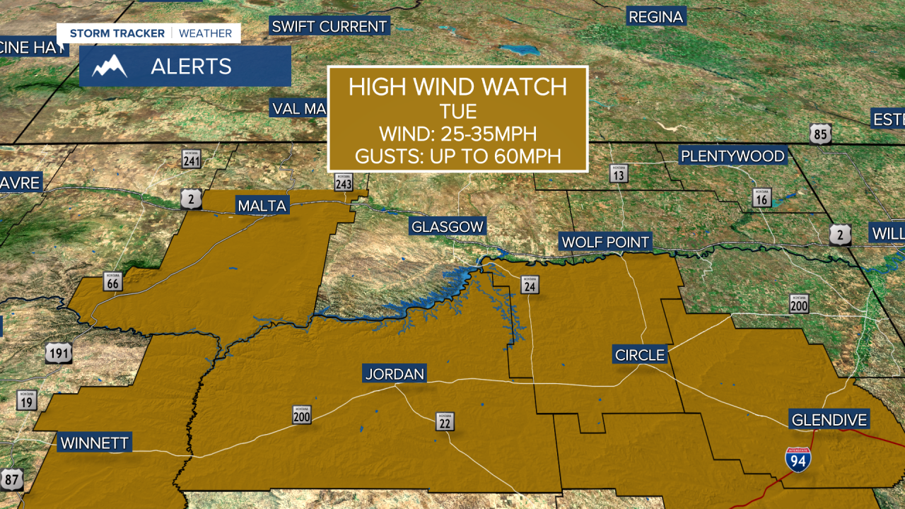
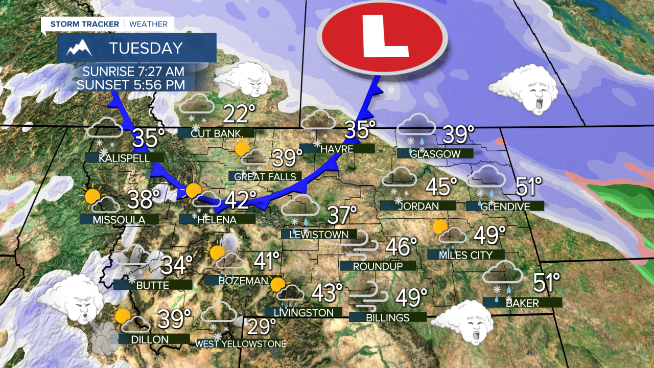
A HIGH WIND WARNING has been issued for parts of central and southeast Montana for Tuesday.
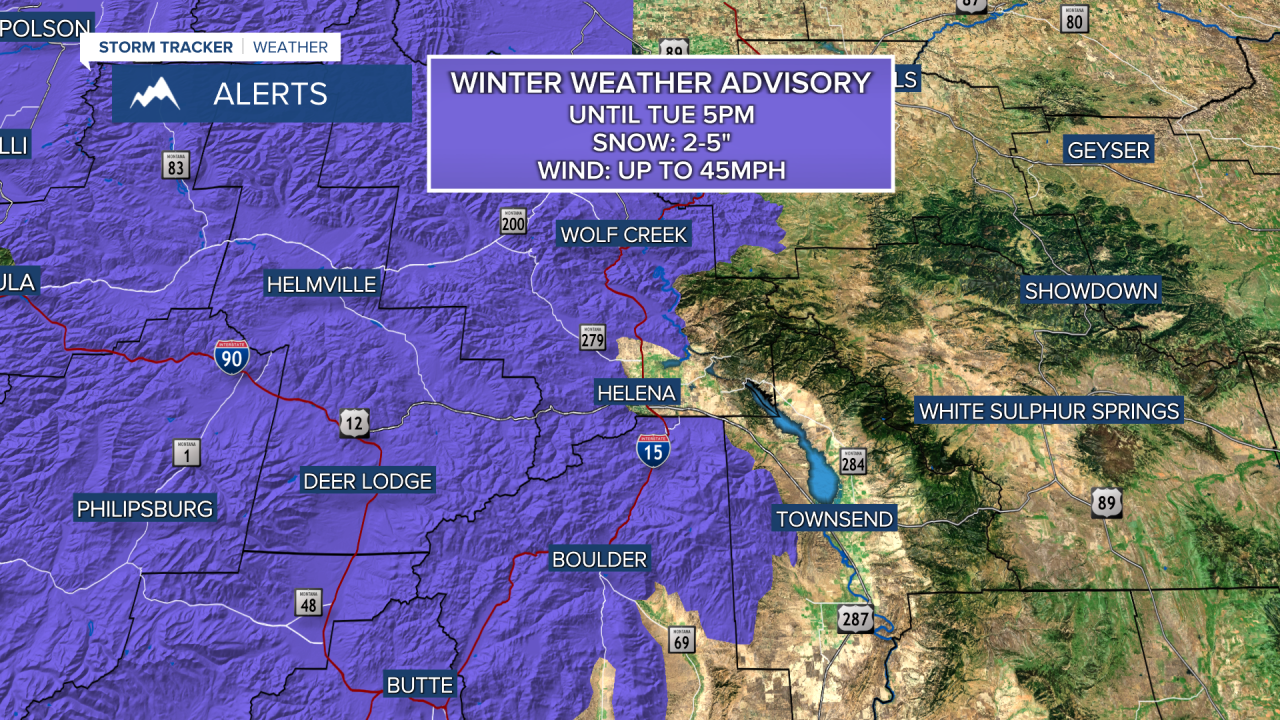
A WINTER WEATHER ADVISORY has been issued for parts of western and northern Montana for Tuesday.
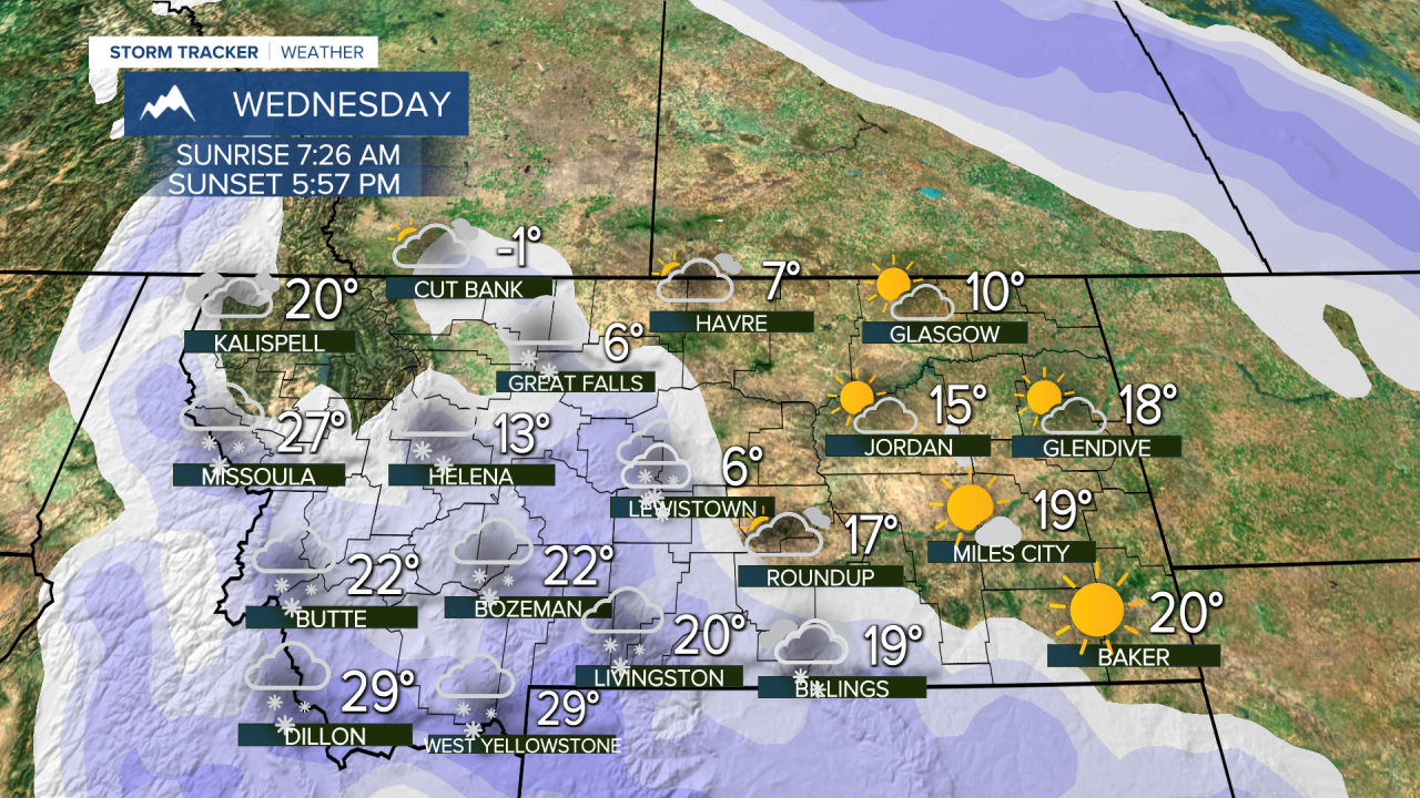
A WINTER STORM WATCH has been issued for northeast Montana for Tuesday night into Wednesday.
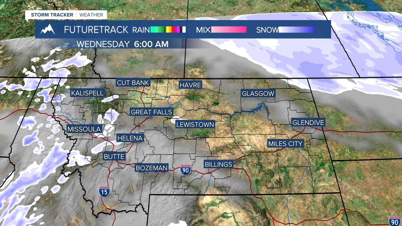
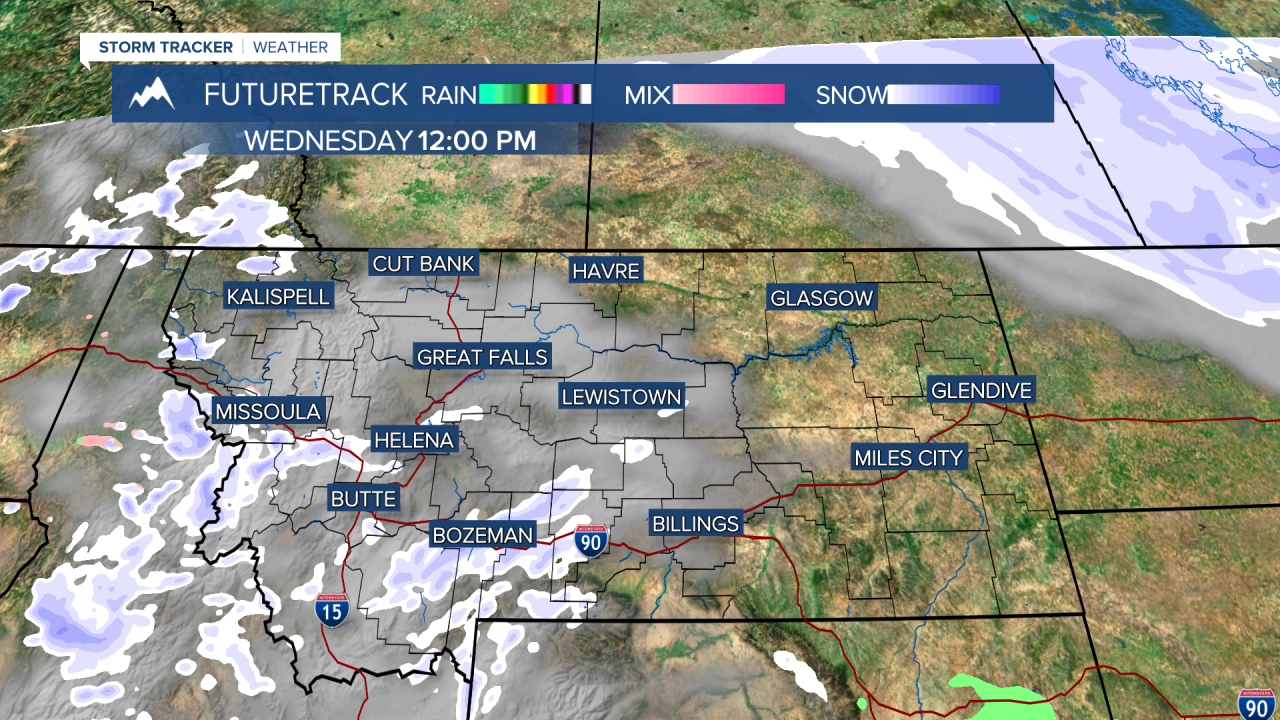
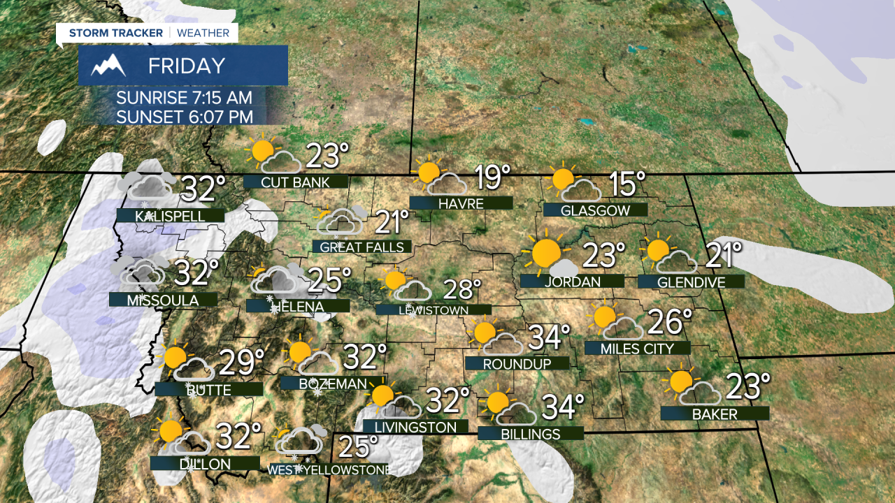
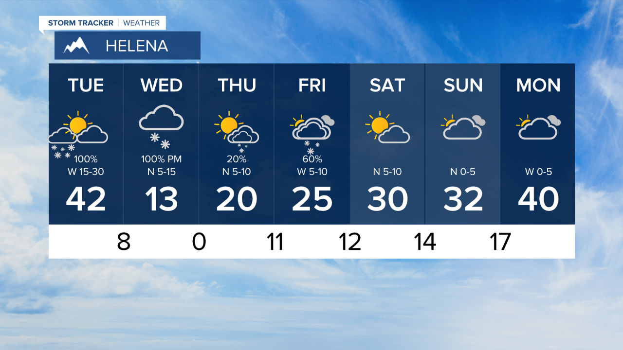
A powerful storm will produce areas of very heavy snow, strong wind, and eventually pull down arctic air from Canada on Tuesday. Thundersnow is possible along the front on Tuesday morning around Helena and Great Falls. A strong area of low pressure will move across the state on Tuesday. Areas of heavy snow will not last all day, but could put down 1-2" in a short amount of time. As much as 6-8" will accumulate in the mountains. The snow will be heaviest in the morning around Helena, late morning near Great Falls, and later in the day for northeast Montana. The wind will be strong as well with some areas of central Montana seeing gusts upwards of 60mph. Highs will be in the 30s to low 40s. An arctic front will come down from Canada behind the low pressure system. Temperatures will tumble through late Tuesday into Wednesday for most of the state, as readings drop to the -0s and 0s for most. Blizzard conditions with blowing snow are possible across northeast Montana Tuesday night into Wednesday. Wednesday will be a cold and cloudy day with areas of light snow redeveloping. There could be another 1-2" from this snow. Highs will be in the -0s to 10s range for most of Montana. Thursday will be partly cloudy and cold with some snow showers. Any accumulation will be light. Highs will be in the 0s up north, 10s and 20s elsewhere. Friday will be another mostly cloudy day with areas of snow showers through the afternoon. Highs will stay cold in the 10s and 20s. The snow should come to an end this weekend with high pressure moving in. Saturday will be partly to mostly sunny with highs in the 10s to near 30. Sunday will be mostly cloudy with highs in the 10s to low 30s. Monday will be briefly warmer as a southwest wind pushes out the arctic air. The rest of February into March should be active with numerous storms, bringing much needed precipitation, and the mountains should at least get typical snow for the time of year.
Have a great day,
Curtis Grevenitz
Chief Meteorologist


