


An EXTREME COLD WARNING continues for parts of northeast Montana for dangerous cold wind chills through Sunday 1pm.
A COLD WEATHER ADVISORY has been issued for parts of northern and eastern Montana for dangerously cold wind chills into Sunday.
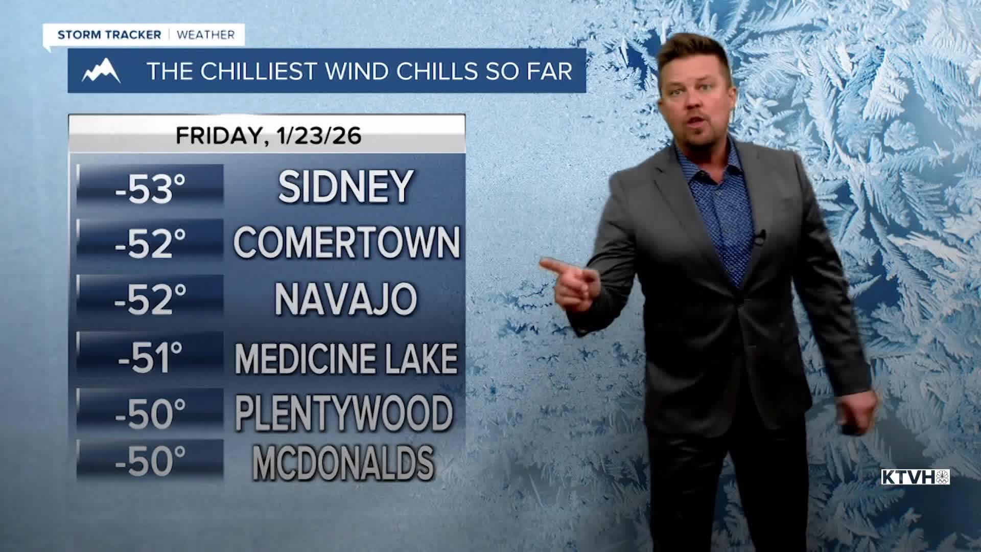
Areas of snow, cold temperatures, slippery roads, wind chills below 0 - it's a January weekend in Montana. Wind chill values have dropped colder than -50 in northeast Montana as the coldest airmass of winter has hit Big Sky Country. Wind chill values could approach -40 to -50 for parts of the Hi-Line through northeast Montana not just through Friday, but all the way into Sunday. Air temperatures could be as cold as -35 in northeast Montana. Elsewhere in the state, wind chills and air temperatures at night will be between 0 and -20. Another cold front will move through the state on Saturday with areas of snow, and a reinforcing shot of cold air. Highs will be in the 10s and 20s but lows will drop to near and below 0 into Sunday morning. Again northeast Montana will be as cold as -30. The mountains could see as much as 12", with 1-3" in the lower elevations possible. The snow will be light and fluffy. Snow will taper off from north to south through Saturday night. Sunday should be mostly sunny with high pressure moving across the state. Highs will range from near 0 over northeast Montana to near 30 closer to the Continental Divide. Bundle up with the warmest clothing and travel safe in these conditions. Speaking of travelers, a major winter storm hitting the south and east coast this weekend will have a big impact on air travel into early next week.
Have a great weekend,
Curtis Grevenitz
Chief Meteorologist
