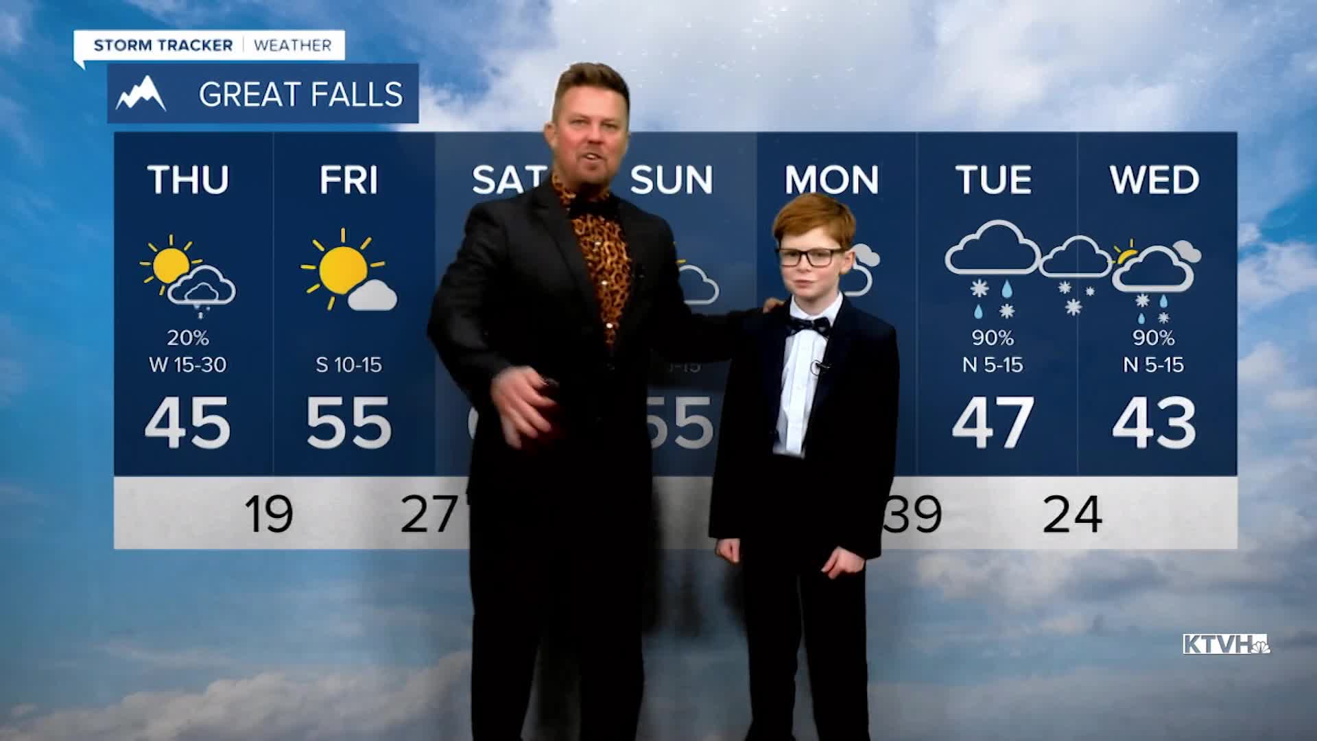


Another atmospheric river is moving through the state with wind and moisture, and some places may get a little surprise of rain and snow into Thursday. Already there have been showers, thunderstorms and mountain snow. A narrow band of rain and snow will continue to move through central and southern Montana into Thursday with some good moisture there. Most fire danger concerns have diminished. Thursday will start out with some of that rain and snow from Highway 12 down to I-90. It will be a colder day with highs in the 30s and 40s, and a pretty chilly wind too. Afternoon snow showers will develop over the mountains with some drifting across the Plains and Hi-Line. Thursday night will be chilly with lows in the 10s and 20s. Friday will be a very nice day with mostly sunny skies and highs in the 50s. This weekend will be pretty nice, generally partly cloudy with highs in the 50s and 60s. The wind will not be too bad. As the month of March winds down, an April Fool's storm is possible. Some rain and snow will spread across the state later Monday but moreso Tuesday and Wednesday. This could be a significant snow for not only the mountains but some of the lower elevations as well. A series of storms could be lined up for the end of March and beginning of April, bringing timely precipitation. Montana is entering the wettest time of year, so it's good to see the likelihood of rain and snow.
Have a great day,
Curtis Grevenitz
Chief Meteorologist
