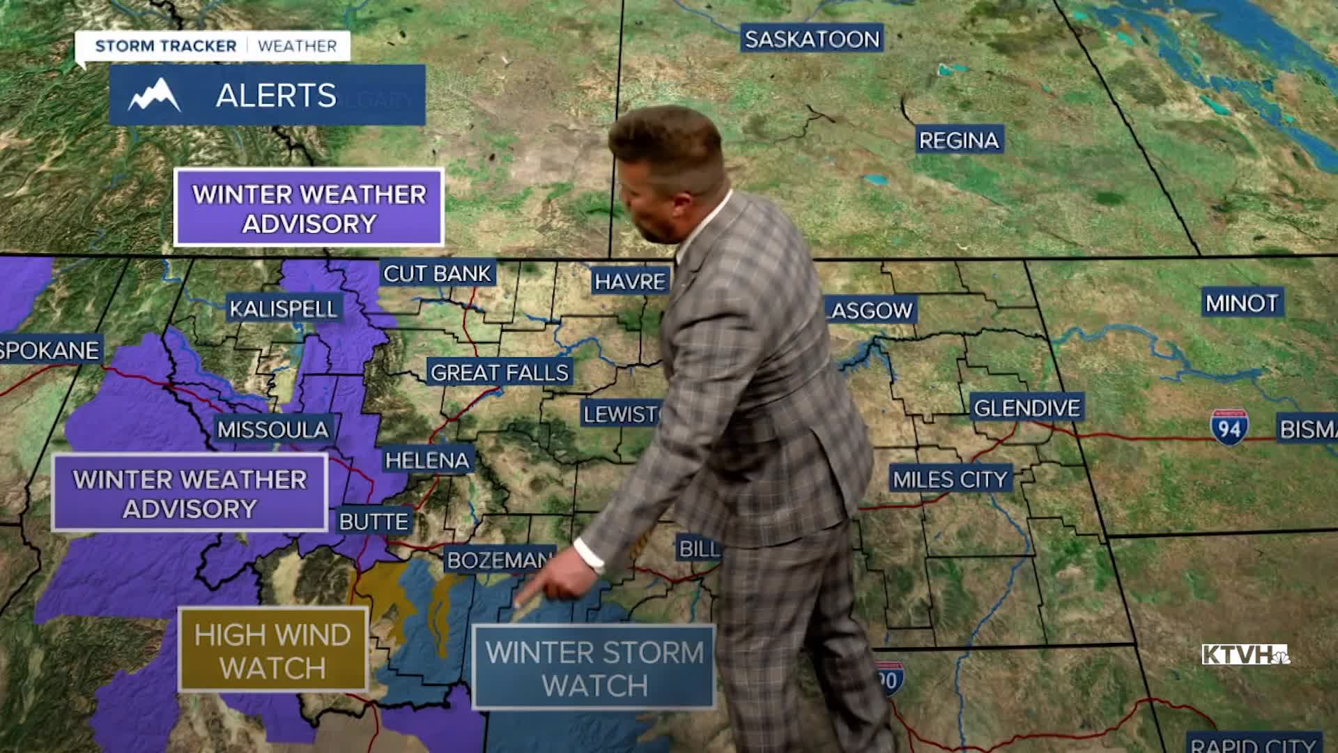


A WINTER STORM WATCH has been issued for the mountains of southern Montana through Thursday.
A WINTER WEATHER ADVISORY has been issued for the mountains of western Montana including Glacier and the Continental Divide into Thursday.
A HIGH WIND WATCH has been issued for parts of southwest Montana through Wednesday.
A new storm system coming down from the Gulf of Alaska will carry a decent amount of moisture and colder air, resulting in widespread snow for Montana and much of the mountains across the West. Rain and mountain snow is already moving into northwest Montana and will continue through the night. Snow will be heavy at times in the mountains into Wednesday morning. Showers and a few thunderstorms will develop through Wednesday afternoon and continue into the evening. Highs will top out in the 50s and 60s, but a sharp cold front moving through in the evening will bring snow levels down to the valleys and plains. Most of the accumulating snow will be in the mountains, but some of the lower elevations could wake up to a coating of snow by Thursday morning. Thursday will be a chilly day with highs only in the 30s to around 40. Under mostly cloudy skies, snow showers will fly across most of the state. The mountains will see a few additional inches of accumulation. Thursday night will be cold with lows in the 10s and 20s. Friday will be partly cloudy with scattered snow showers over the mountains, and some mixed rain/snow showers in the lower elevations. Highs will only warm into the 40s. The weekend weather will be a little more "settled" as high pressure moves in. Saturday will be mostly sunny with near average highs in the 50s. Sunday will be mostly sunny as well with highs in the 60s. The entire weekend will be dry, something we deserve after a couple of stormy spells. Warm, dry and sunny weather will continue early next week.
Have a great day,
Curtis Grevenitz
Chief Meteorologist
