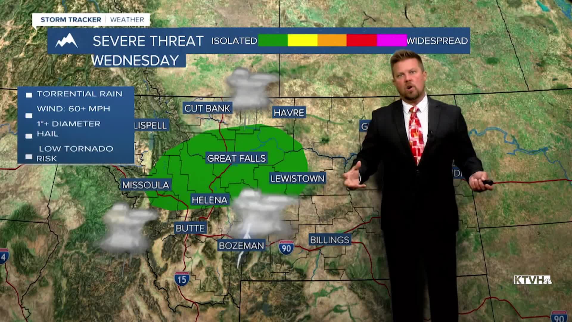


Happy Monday! It is a happy Monday weather-wise, as the beautiful weekend weather has carried over into the workweek. Tuesday will be another spectacular day with mostly sunny skies, much lighter wind, and warm temperatures throughout the state. Highs will top out in the 70s to around 80. Wednesday will start out warm and dry but it will not end that way. High temperatures will reach the 80s to even around 90 in eastern Montana. That heat will fuel thunderstorms as a storm system moves into Montana. There is the likelihood of strong to severe thunderstorms developing Wednesday afternoon. Some of the storms could have large hail and damaging wind. Please keep an eye to the sky. A strong cold front will move through the state on Wednesday night into Thursday. There will be more thunderstorms, rain, mountain snow, and strong wind. Thursday will be partly to mostly cloudy with some showers and higher mountain snow, but the wind will be vicious the entire day. Some gusts could top 50-60mph. Highs will be in the 50s and 60s. Friday will be partly cloudy with an isolated shower or thunderstorm, highs will be in the 60s to near 70. This weekend will be a little more unsettled than last, with partly cloudy skies and isolated showers on Saturday. Some snow showers are likely in the mountains. Highs will be in 50s and 60s. Sunday will be unsettled with mostly cloudy skies, scattered showers and mountain snow showers. Highs will be in the 40s and 50s.
Enjoy the warmth while we have it!
Curtis Grevenitz
Chief Meteorologist
