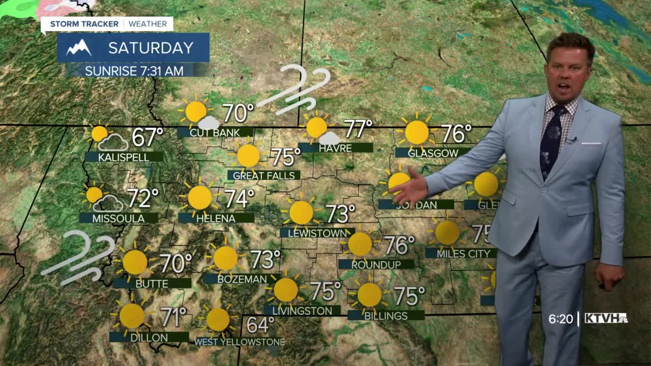


It's beautiful, but boy is it dry. Exceptional drought conditions are now across much of northeast and southwest Montana. This situation does not look like it will improve anytime soon and the weather will continue to be very warm and very dry. Even though the last few days have been colder with less wind, wildfire activity increased on Thursday in Montana and Idaho. The Haystack Fire southwest of Boulder continues to be active and emitted enough smoke to affect the Helena area's air quality. And surprisingly the Woods Creek Fire in the Big Belt Mountains flared up in an interior pocket. Fires in Idaho also started back up after a few days of inactivity. This is an indication of how dry things are, and it likely will be over a week before any significant precipitation moves across the state. Friday will have increasing clouds and an slight chance of a shower through the afternoon and evening. Any rain will be welcome, although the precipitation will not be that significant or widespread. A few showers may continue into Saturday morning for central and eastern areas, but sunshine will increase through the day. Highs will be in the 70s and a west wind may kick up to 20mph in the afternoon. An increase in the wind will likely mean an increase in fire activity. Sunday will be gorgeous with sunny skies in western areas, but a few more clouds in far eastern Montana. Highs will be in the 70s to around 80. More fall warmth is likely early next week with highs in the 70s and low 80s. It does not look like significant rain or snow is likely until possibly late next week. At that time, temperatures will cool enough for rain in the lower elevations and some snow in the higher terrain. Help is on the way, it's just a ways off.
Curtis Grevenitz
Chief Meteorologist
