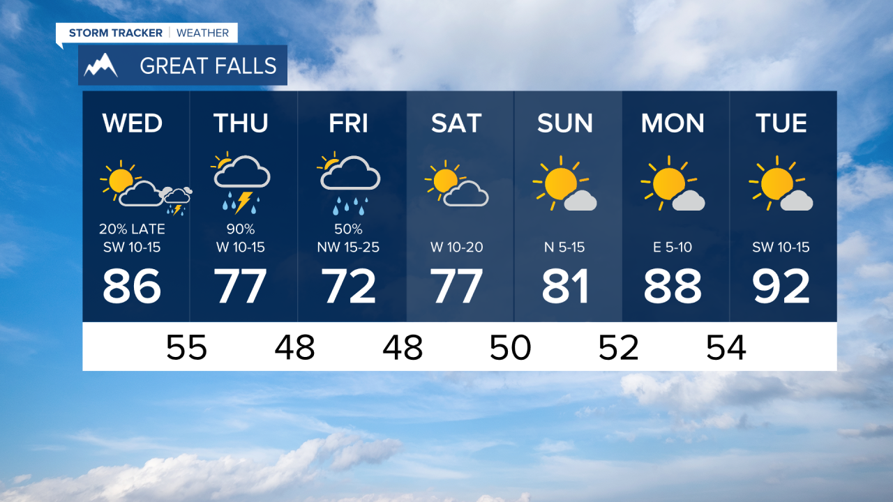
It's been a stormy summer with an unusual amount of thunderstorms, but Tuesday and Wednesday are a little break before storms return Thursday. Wednesday will be another mainly quiet day. Most of the day will be dry with partly to mostly sunny skies. Highs will top out in the 70s and 80s. However, the next storm system will start spreading clouds across western Montana late in the day. A few isolated thunderstorms are possible near Helena and Great Falls late. This storm system will hit hard on Thursday with widespread strong and severe thunderstorms. Thursday will be partly to mostly cloudy with storms pushing across the state. Highs will mainly be in the 70s, but cool off into the 50s and 60s in areas of rain. It will be cold enough for even some snow on the mountain tops Thursday night. Scattered showers and storms will continue Thursday night into Friday. The storm will be slow to clear on Friday with scattered showers and thunderstorms lingering, especially up on the Hi-Line and across eastern Montana. Highs will be cool in the 60s and 70s. Good news though, the storm should clear for the weekend which will be very nice. Skies should be mostly sunny with highs in the 80s.
Have a great day,
Curtis Grevenitz
Chief Meteorologist


