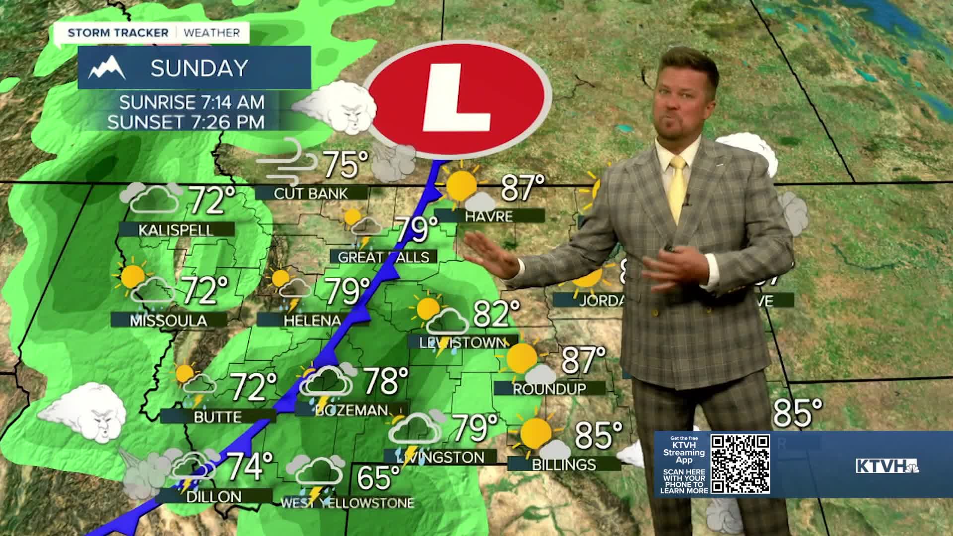


The final weekend of summer will be about 75% beautiful, sunny and warm. Sunday afternoon will take a stormy turn but until then it will be fantastic. Saturday will be partly to mostly sunny and warm with highs in the 70s and 80s. Wind will pick up through the afternoon on the Continental Divide and the Rocky Mountain Front but most of the state will be beautiful. Sunday will be partly to mostly cloudy as a front moves through the state with scattered showers and thunderstorms in the afternoon. Some moisture from the remnants of tropical storm Mario will be drawn into this front and rain could get heavy at times later Sunday evening. Wind gusts could top out around 30-40mph along and behind the front. Highs will be slightly cooler in the 60s and 70s, still some 80s out across eastern Montana. Monday is the first day of autumn and it will be cooler and breezy with highs in the 60s and 70s. There will be some rain in far eastern Montana. Most of next week looks warm, dry and sunny.
Have a great weekend,
Curtis Grevenitz
Chief Meteorologist
