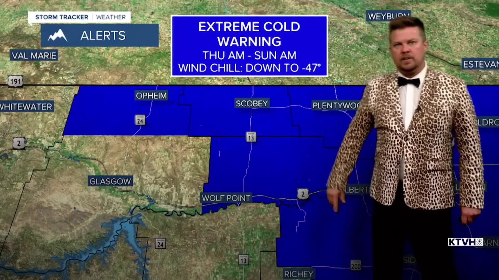


An EXTREME COLD WARNING has been issued for parts of northern and northeast Montana for dangerous cold wind chills.
A COLD WEATHER ADVISORY has been issued for parts of eastern Montana for dangerously cold wind chills.
Most would say winter has been very mild thus far but a surge of arctic air will push wind chills down to -40 to -50 in parts of Montana. Thursday, another cold front will move through the state in the morning with temperatures falling through the day. High temperatures in the 10s to around 20 will occur in the morning with numbers falling into the 0s and -0s by evening. Some flurries or light snow is possible but there will be little to no accumulation. Thursday night will be the coldest with temperatures dropping to near -20 across northeast Montana, and much of Montana east of the Continental Divide will have lows at or colder than zero. Wind chill values could approach -40 to -50 for parts of the Hi-Line through northeast Montana. Elsewhere in the state, wind chills will be between 0 and -20. Friday will be partly to mostly cloudy and cold with highs in the 0s and 10s, some -0s across northeast Montana. Some light snow will move through the state with a coating up to an inch possible. Another cold front will move through the state on Saturday with mostly cloudy skies, scattered snow showers, and a reinforcing shot of cold air. Highs will be in the 10s and 20s but low will drop to near and below 0 into Sunday morning. Sunday should be mostly sunny with high pressure moving across the state. Highs will range from near 0 over northeast Montana to near 30 closer to the Continental Divide. A more significant snow is possible Tuesday into Wednesday. There is plenty of winter left...
Have a great day,
Curtis Grevenitz
Chief Meteorologist
