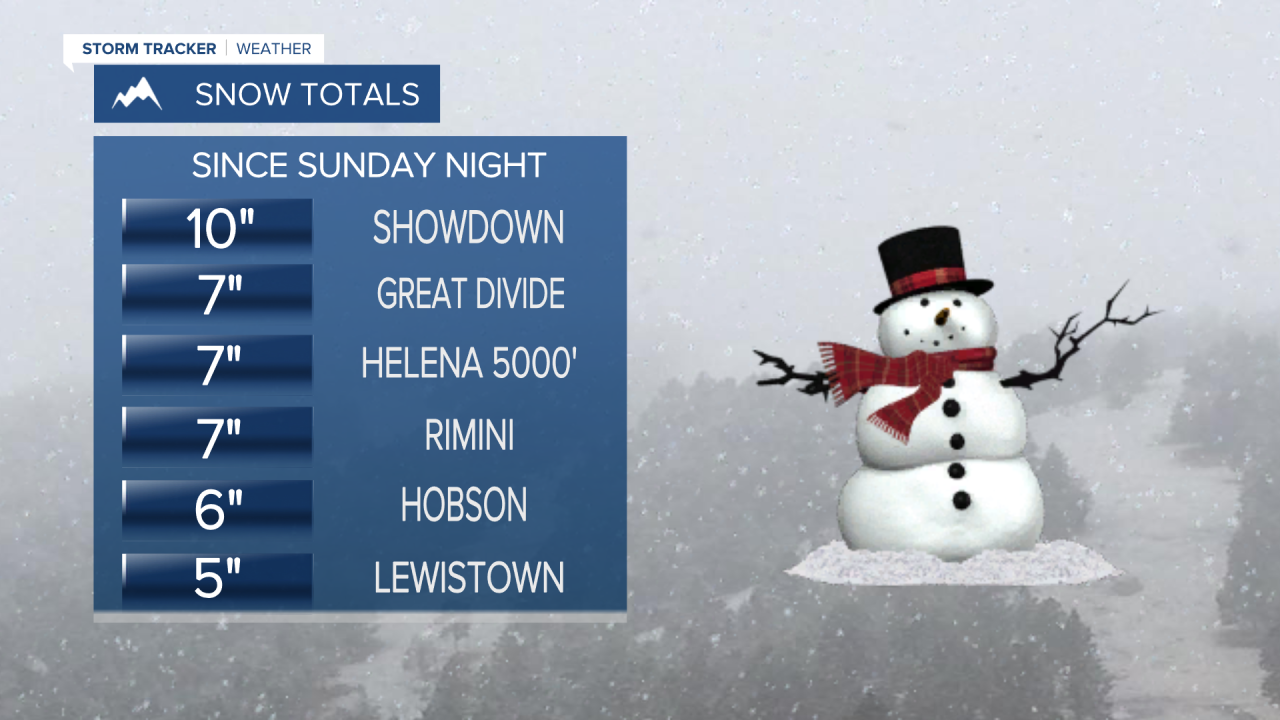
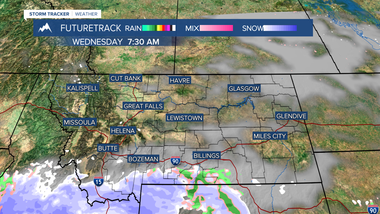
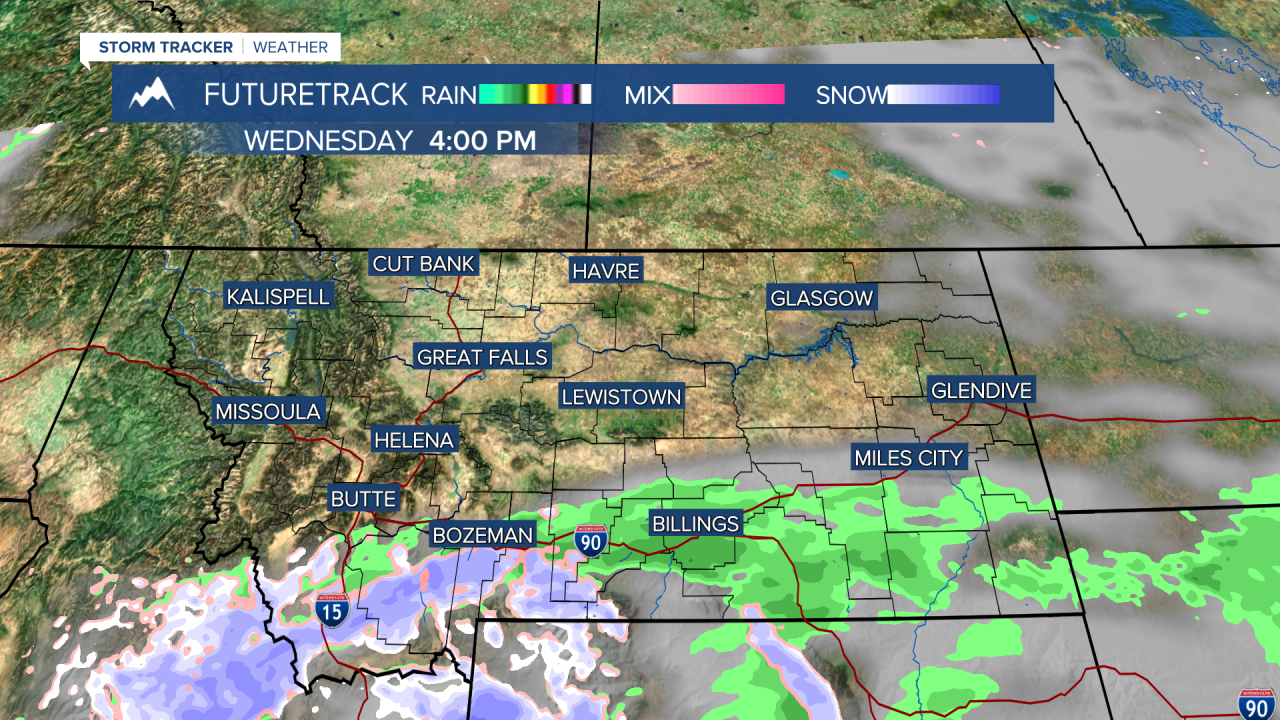
A powerful storm finally broke the stretch of dry and warm weather with a significant snow and much needed moisture across the majority of Montana. Up to a foot of snow fell in the mountains, with up to an inch of liquid equivalent. Thundersnow occurred near Great Falls and Bozeman, a sign of the intensity of the storm. In the Capital, Helena not only broke a record for the day, but received more precipitation from this one storm than typically occurs the entire month of February. So if it did not rain or snow at all the rest of the month, Helena would finish February with above average precipitation. But there will be more snow and colder temperatures through the rest of February. The dry, warm and dull pattern is over. The storm will continue to move out by Tuesday morning. Some areas of fog and slippery conditions are possible in the wake of this storm. Tuesday will have a good amount of sunshine with highs in the 30s and 40s. Wednesday a little snow will fall in southern Montana along I-90, but most of the rest of the state will be dry with comfortable temperatures and decent sunshine. Thursday and Friday will be partly to mostly sunny with highs in the 30s and 40s. A few places in the plains could even clip 50 degrees. Saturday is Valentine's Day and the weather looks mostly cloudy with highs in the 40s. A few snow showers are possible in the western mountains. Sunday the chance of snow will increase through the day as a new storm moves in. Areas of snow are possible Monday as well. Overall the next few weeks will feature multiple storms and seasonable temperatures, so there's a chance Montana plays a little catch-up in the snow department.
Have a great day,
Curtis Grevenitz
Chief Meteorologist


