A RED FLAG WARNING is in effect for most of Montana through Thursday.
An EXCESSIVE HEAT WARNING is in effect for eastern Montana through Thursday.
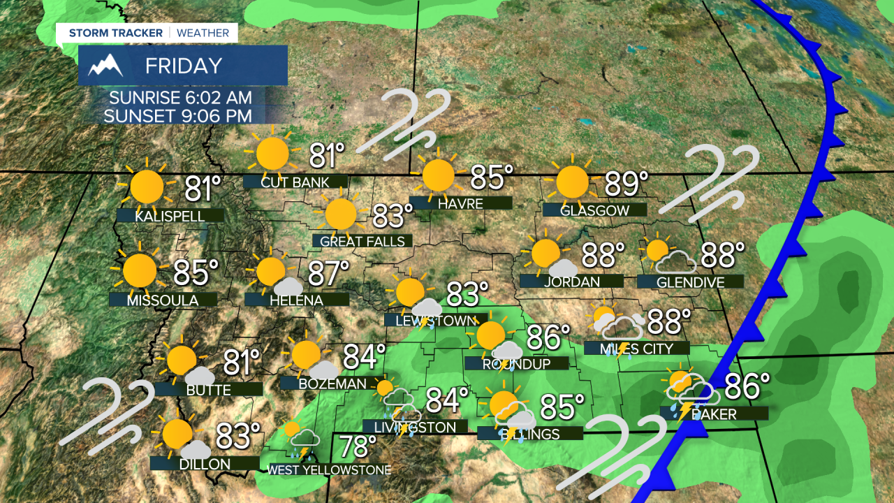
Wednesday was a record breaking day for heat in some parts of Montana. Cooler air will start to move in for Thursday but the fire danger will be worse, some of the worst it can be. The next several days will be brutal with near record heat and the likelihood of wildfires exhibiting tremendous growth. Please do all you can to stay cool and not start a new fire. This is a very dangerous situation with thunderstorms and lightning strikes through Wednesday night followed by continued heat and strong wind Thursday. Temperatures will not be quite as hot as a cold front will move from western Montana into the eastern part of the state on Thursday with scattered thunderstorms. Strong wind will develop and the fire danger will be extreme. Any new wildfire starts will likely grow in the heat, low humidity and wind. Temperatures will begin to slowly cool, with highs in the 90s and low 100s. A cooler airmass will move in for Friday with highs in the 70s, 80s to around 90. The wind will not be as strong, but it could still push wildfires. Friday night's temperatures will fall into the 40s and 50s for lows, certain relief from the heat. Saturday will be mostly sunny with a few isolated thunderstorms and highs in the 70s and 80s. Sunday will be mostly sunny with highs in the 80s to around 90. These weather conditions are about as bad as they can get for fires. Please be careful. There is cooler weather and lesser fire danger headed to the state for Friday and the weekend, we just have to make it there.
Stay safe,
Curtis Grevenitz
Chief Meteorologist


