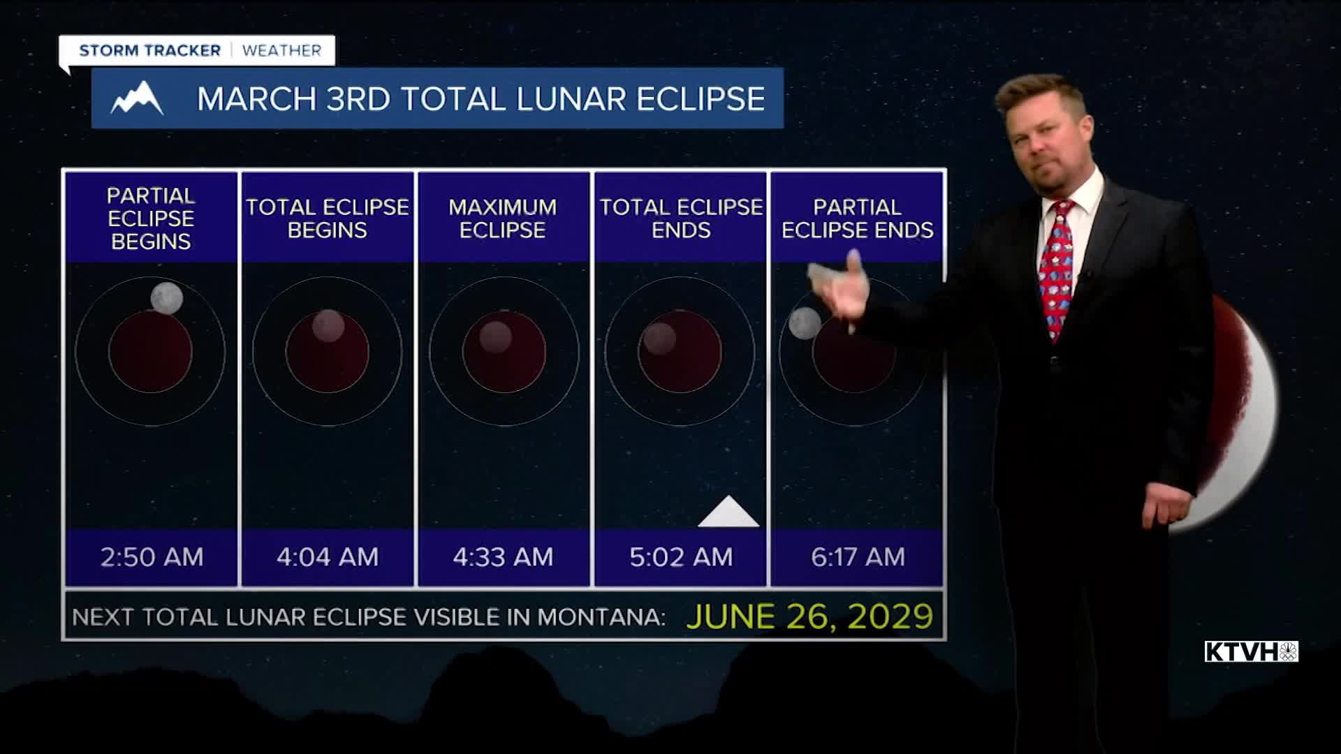


Skies will be mainly clear through the night, making for excellent viewing conditions for the early morning lunar eclipse. It's a total lunar eclipse, beginning right around 3am. The totality will last from about 4am to 5am, with the eclipse ending just after 6am. Tuesday will be a beautiful, spring-like day with mostly sunny skies and warm temperatures in the 50s and 60s. There will be wind over the plains and Continental Divide, gusting up to 30mph. Wednesday will not be as nice with clouds increasing through the day. It will still be mild with highs in the 50s. The wind will be breezy over the plains. Late in the day a cold front will move into western Montana with a mix of rain and snow in the lower elevations, the mountains will see snow. This is not a huge storm, but it will bring some moisture to the state. Some areas of rain and snow will move through into Thursday morning. The mountains will pick up a few inches of snow, the lower elevations will see just a little moisture. Areas of snow will continue in the mountains on Thursday with just a few rain/snow or snow showers in the lower elevations. Highs will be in the 30s and 40s. The heaviest precipitation will be across the southern mountains. That storm will move away on Friday with just a chance of a few lingering mountain snow showers. Highs will be in the 40s to near 50 for the lower elevations, 20s and 30s in the mountains. Saturday will be warm and windy with highs in the 50s and 60s. Skies will be mostly sunny to partly cloudy. The wind will really howl, and a high wind warning may be needed for the Rocky Mountain Front at least. A cold front will move across the state on Sunday with gusty wind and just spotty rain/snow showers. Highs will cool into the 40s and 50s. A stronger front will likely move across the state on Monday with more widespread rain and snow. Behind that front, colder air will move in for most of next week. There will be snow around each day.
Have a great day,
Curtis Grevenitz
Chief Meteorologist
