


A HIGH WIND WARNING continues for the Continental Divide, Rocky Mountain Front, and parts of Judith Basin County through midnight.
A WIND ADVISORY continues for areas west of the Continental Divide until midnight.
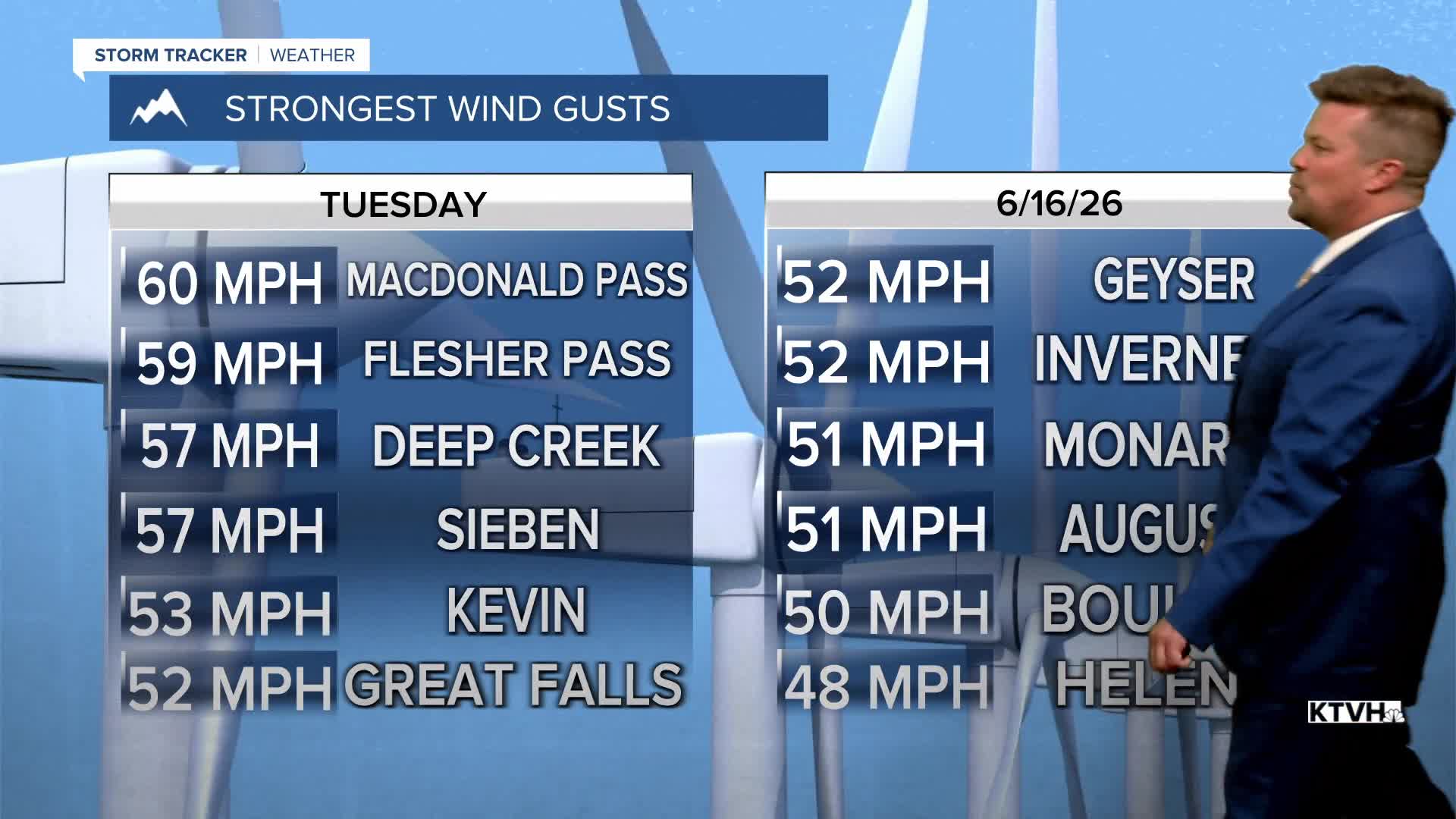
Most of Montana has had a pretty windy day with peak gusts topping out at 60mph. A front is producing the wind and also thunderstorms for part of Big Sky Country. Most of the storminess is up on the Hi-Line, and some storms will drift across central Montana near Great Falls and Lewistown tonight. The wind will ease up for most areas after dark. Wednesday will be a breezy day still but the wind will be much lighter than Tuesday. The strongest wind will be across eastern Montana, gusting to more than 40mph. Wednesday will be a cooler day with highs in the 60s and 70s. There will be partly to mostly cloudy skies with scattered showers and a few thunderstorms. Thursday will be a quieter, calmer day with partly cloudy skies and highs in the 70s. A few isolated thunderstorms are possible around the East Glacier area down to Great Falls and across northeast Montana. Friday will be a nice late spring day with partly cloudy skies, a light breeze, and highs in the 70s to near 80. This weekend will start out nice with partly cloudy skies and warm temperatures in the 70s and low 80s, but clouds will increase along with a few thunderstorms on Saturday afternoon. Sunday is Father's Day and the beginning of summer. Skies will be partly to mostly cloudy with scattered showers and cooler temperatures in the 50s and 60s. Any rain should be light.
Have a great day,
Curtis Grevenitz
Chief Meteorologist
