

A FLOOD WATCH continues for most of central and western Montana into Wednesday.
A FLOOD WARNING is in effect for the Dearborn River.
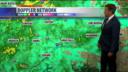
A big late June rainstorm will continue to impact the state for the next several days. Moderate to heavy rain will fall through Monday night into Tuesday. The heaviest rain will be on the Rocky Mountain Front, thus any river or creek flowing out of this area will have the potential to flood. Tuesday will start out with rain in western Montana that will cross the Continental Divide and work east through the afternoon and evening. While the rain won't be as heavy and widespread, Tuesday will still be a wet and cool day. Highs will only be in the 50s and 60s. Wednesday will be a drier day with more sunshine until the afternoon when scattered thunderstorms will develop. Thursday should be a completely dry day with mostly sunny skies and highs in the 70s. Friday will be mostly sunny and warm, but a few isolated thunderstorms will develop in the afternoon and evening. Independence Day on Saturday will be similar with highs in the 70s and low 80s, and isolated thunderstorms will develop through the afternoon and evening. Sunday has potential to be a stormy day with scattered thunderstorms moving throughout the state. A few thunderstorms are possible on Monday too. Unusually wet weather for July could continue next week with scattered thunderstorms sticking around.
Please remember if you encounter floodwater over a road, please turn around and don't drown. It's difficult to tell how deep the water is and if the road has been washed out underneath.
Have a great day.
Curtis Grevenitz
