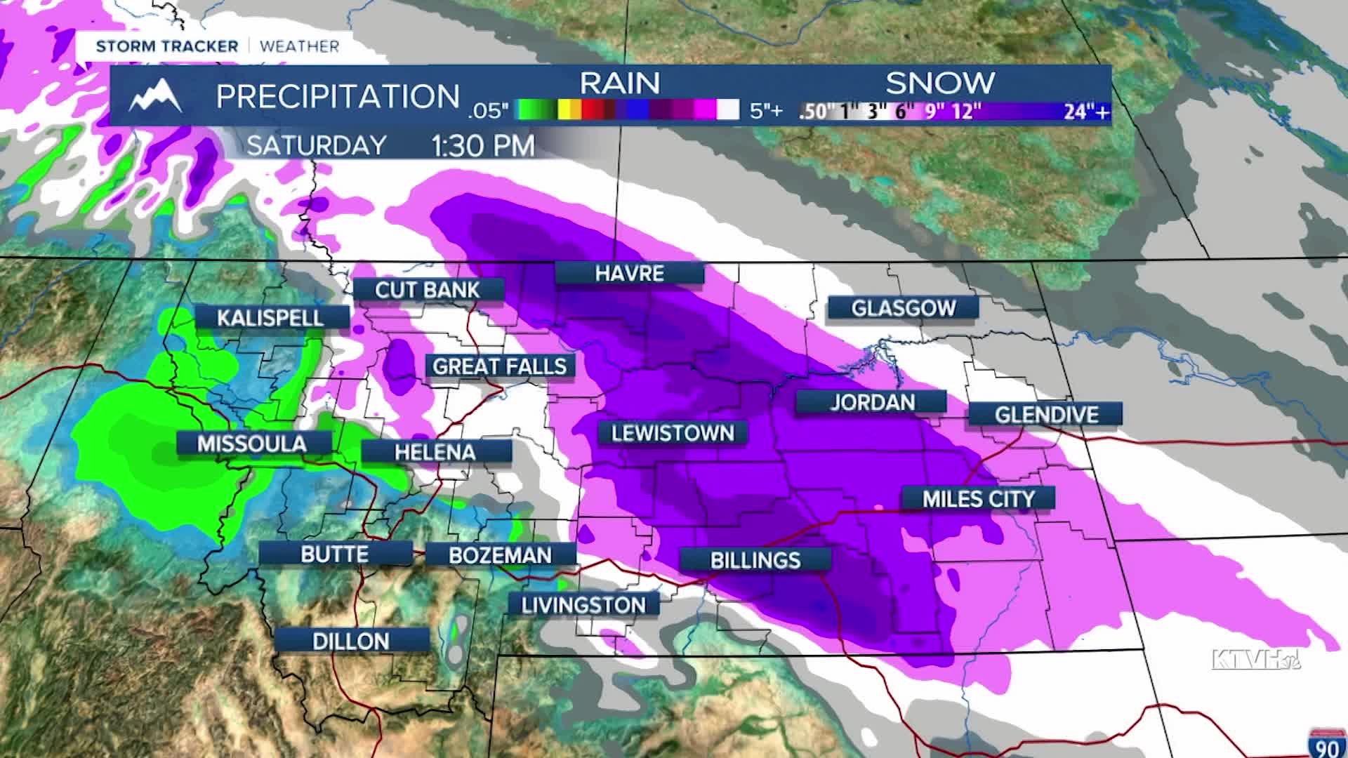


A WINTER STORM WARNING has been issued for most of central Montana through Friday.
An EXTREME COLD WARNING has been issued for northeast Montana for wind chills down to -40.
A COLD WEATHER ADVISORY has been issued for parts of the Hi-Line into Saturday.
WINTER WEATHER ADVISORY has been issued for parts of western, southern and eastern Montana through Friday.
The atmospheric river is now running into an arctic airmass, resulting in snow and freezing rain that will make for very slippery conditions through Friday. It's been a week of wild weather already and this active pattern will continue with extreme cold and heavy snow making for dangerous travel conditions. It's been icing up as wet roads freeze quickly with the arctic air advancement. Some areas in the state have dropped 30-50 degrees since this morning. The arctic air will mainly not cross the Continental Divide, but the Blackfoot Valley will see some cold air too. Areas of snow and freezing rain will continue Thursday night and Friday. Friday morning's commute will be very slippery . Several inches up to a foot will accumulate across central and northern Montana through Friday. Southern Montana by Bozeman and Butte will be much warmer with little to no snow. Some snow and areas of light freezing rain will continue into Saturday morning. Northeast Montana will start out in the arctic air with temperatures below zero, but southwest Montana will stay warm in the 40s for highs. The arctic air will retreat through Sunday into early next week, with more Pacific air moving in. However, this extremely variable weather will likely return for the middle to end of next week. It's going to be a wild weather ride, possibly through Christmas.
Be safe out there,
Curtis Grevenitz
Chief Meteorologist
