


A HEAT ADVISORY continues through Wednesday for eastern Montana.
A RED FLAG WARNING has been issued for Wednesday for southwest Montana.
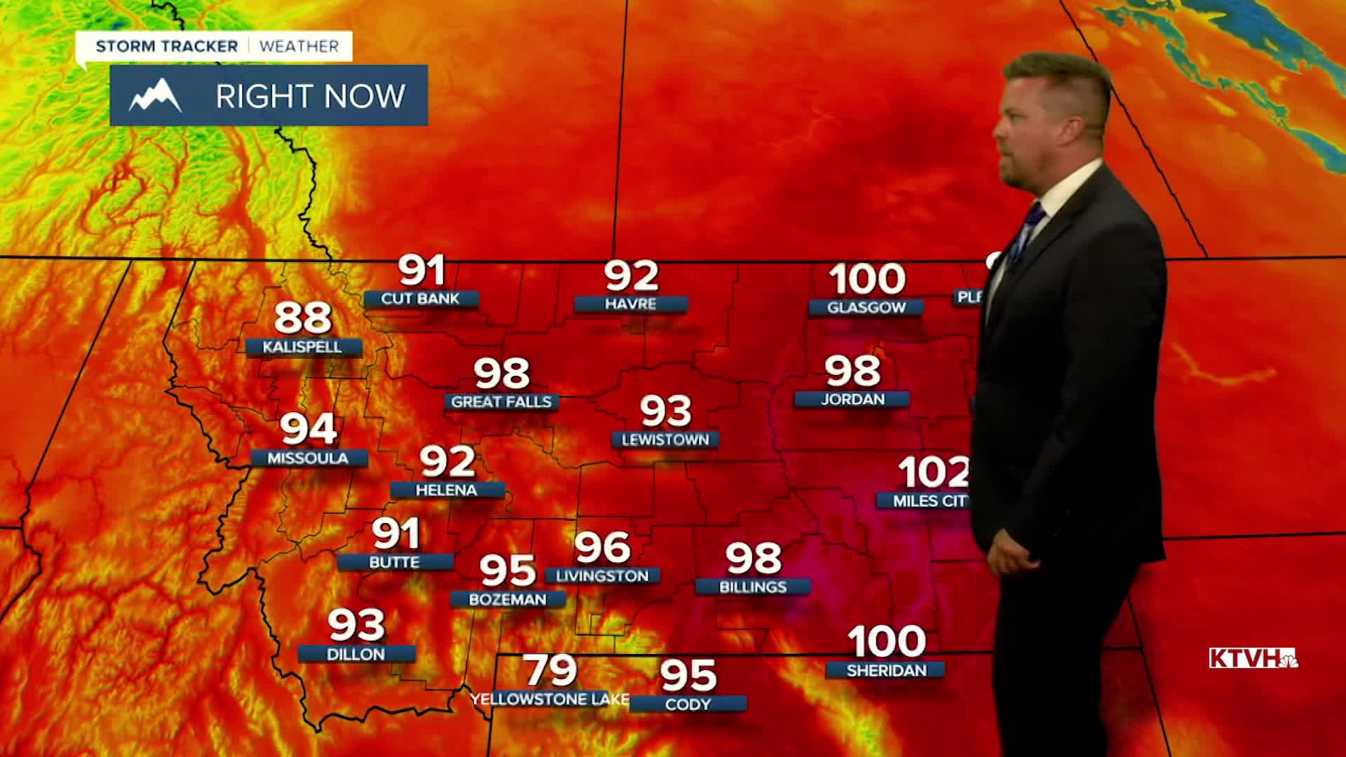
Tuesday was one of the hottest days of summer and the year, but cooler weather is on the way soon with beautiful conditions this weekend. Great Falls had a new daily record high of 100, breaking the old record of 97. This was the first time Great Falls hit 100 this year. Helena did not break a record and has not hit 100 yet this year. Several places like Glasgow and Miles City hit the low 100s. Not just relief, but beautiful weather in heading to Montana. A cold front will start moving through the state on Wednesday. It will still be hot with most areas topping out in the 90s to around 100 but it will be cooler than Tuesday. A few thunderstorms will pop through the afternoon and evening. The cold front will move through the state by Thursday morning and much more refreshing air will move in. Thursday will be mostly sunny with highs in the upper 70s to mid 80s. Canadian high pressure will build into the state for Friday and the weekend. Friday will be comfortable cool for summer with below average highs in the 70s to around 80. Overnight lows will be in the 30s and 40s. Saturday will be gorgeous with highs again in the 70s to low 80s. Sunday will be a little warmer with highs in the upper 70s to mid 80s under mostly sunny skies.
Have a great day,
Curtis Grevenitz
Chief Meteorologist
