
A HIGH WIND WATCH has been issued for Saturday afternoon and evening.
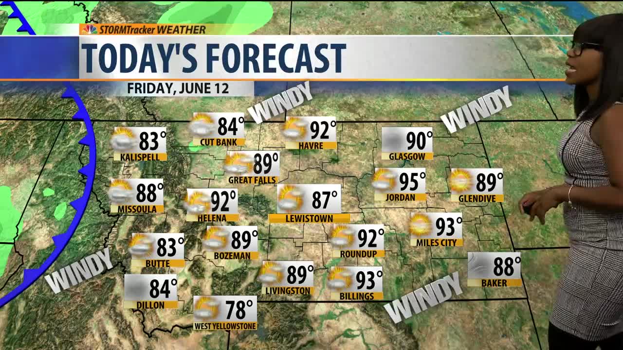
A southerly flow will aid in the increase in temperatures. The high temperatures will climb to the 80s and 90s. The beginning of the day will start with partly sunny skies, but by the evening, isolated thunderstorms will develop in the western half of the state. Tomorrow the state will have partly cloudy skies and above-average temperatures. Portions of eastern Montana temperatures will come close to hitting 100 degrees. A cold front will keep parts of western Montana in the 60s. The cold front will pass during the afternoon, and will be accompanied by strong winds, and scattered thunderstorms. The wind will be sustained between 20-50mph at times with gust up to 70mph. If you happen to have any outdoor patios chairs, you may want to put them up. On Flag, it will be mostly cloudy with cooler temperatures, and gusty wind. The mountains will have snow showers, and the lower elevations will have rain showers and thunderstorms. The southern part of the state will have heavier downpours in the lower elevations and accumulating snow in the mountains.
Enjoy your day, and congratulations to all 2020 graduates🎓
A.R.😊
