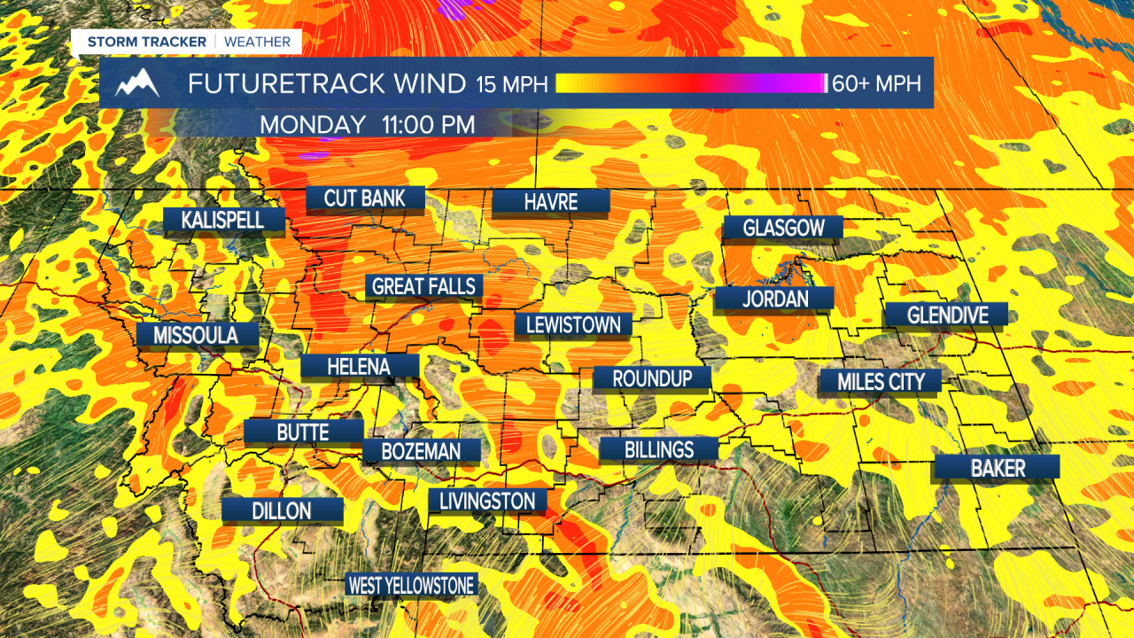
A beautiful start to the workweek is in store for Montana on Monday. Helena and surrounding areas will be under dense fog for the first half of Monday but that should clear up by mid day. High presssure allows for a seasonably warm start to the week before our next weather maker rolls in from the northwest. As a Canadian Cold Front drops down from the northwest overnight into Tuesday morning, rainfall will fall across most of the state. Snow will mix in around 6000 feet but accumulation should be around one inch at most. High wind will be present along the Rocky Mountain Front Monday, especially the Northern Rocky Mountain Front but should remain under wind warning levels. Tuesday afternoon through the rest of the week will be mostly sunny to clear with temperatures slightly above seasonal averages thanks to another building of a high pressure fueled ridge. As always: A cloudy day is no match for a sunny disposition.
Be nice to each other.
- Trey Tonnessen -

<a href="https://stock.adobe.com/search?filters%5Bcontent_type%3Aphoto%5D=1&filters%5Bcontent_type%3Aillustration%5D=1&filters%5Bcontent_type%3Azip_vector%5D=1&filters%5Bcontent_type%3Avideo%5D=1&filters%5Bcontent_type%3Atemplate%5D=1&filters%5Bcontent_type%3A3d%5D=1&filters%5Bcontent_type%3Aimage%5D=1&filters%5Bcontent_type%3Aaudio%5D=0&filters%5Binclude_stock_enterprise%5D=0&filters%5Bis_editorial%5D=0&filters%5Bfree_collection%5D=0&k=crockpot+chicken&order=relevance&safe_search=1&limit=100&search_page=1&search_type=usertyped&acp=&aco=crockpot+chicken&get_facets=0">Adobe</a>


Posted

