A DENSE FOG ADVISORY is in effect for most of northern Montana, the Helena Valley and the Gallatin Valley into Tuesday.
A WINTER WEATHER ADVISORY is in effect for western Montana into Tuesday.
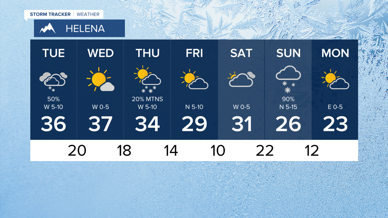
A complicated weather setup is already producing dense, freezing fog and will create areas of snow, rain and freezing rain. There are layers to the atmosphere like a stack of pancakes. A layer at the ground has a lot of moisture and is producing fog and freezing fog. A layer above the ground is above freezing, which could produce rain and freezing rain. A small but potent area of low pressure is moving through these layers and will yield a mixed bag of precipitation that will lead to locally heavier snow and slippery spots. Some light snow and rain have already developed and will continue through Monday night into Tuesday morning. Heavier precipitation and potentially more snow accumulation will occur across north-central Montana. Some locations including Great Falls and Helena could have rain, freezing rain and/or snow at times making for slippery conditions. Areas of fog along with freezing temperatures will add to the slick spots. This small area of low pressure will work north and east through Tuesday. Some lingering snow will continue on Tuesday near Great Falls, with just a few snow showers around Helena. Dense, freezing fog may continue well into Tuesday. Highs will be in the 30s. As much as 1-3" of snow could accumulate in the lower elevations with up to 6" in the Elkhorn and Little Belt Mountains. Some areas of snow will move into eastern Montana later Tuesday. This low will clear on Wednesday with increasing sunshine and highs in the 30s to near 40. A fast moving front will bring snow showers to the mountains and mainly west of the Continental Divide on Thursday. Highs will be in the 20s and 30s under partly to mostly cloudy skies. Friday and Saturday will be quiet and seasonably cool with highs in the 20s and 30s. Clouds will increase Saturday ahead of another front. This storm system will bring widespread snow to much of Montana Saturday night into Sunday. A light accumulation of a few inches is possible. Slightly colder temperatures with highs in the 20s will move in for Monday. The rest of January looks more like January than the first few weeks of the month. There will be more opportunity for snow and colder but not brutally cold temperatures.
Curtis Grevenitz
Chief Meteorologist


