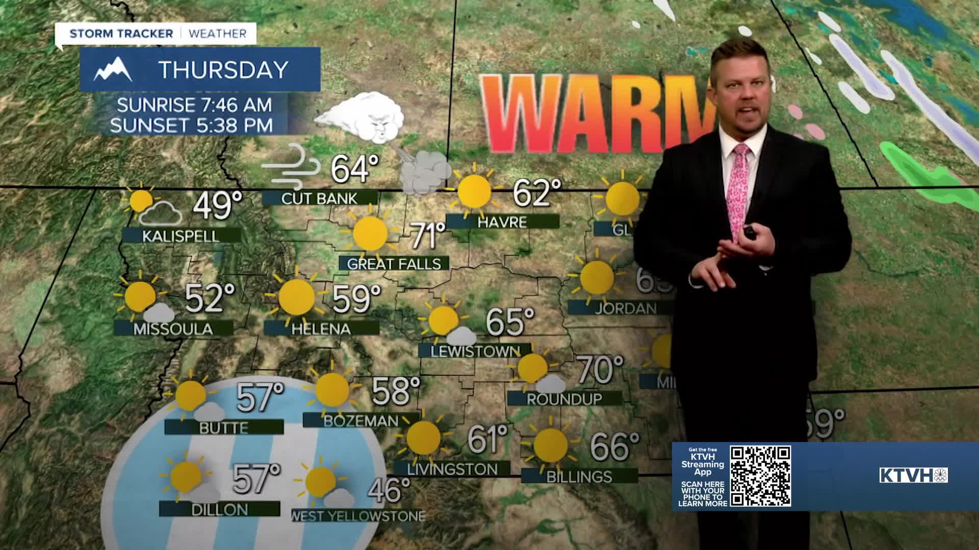


If you thought Wednesday was warm, Thursday will be even warmer as not only will some towns set daily record highs, a few places will have their warmest February temperature ever on record. Several towns hit record highs, and a few places like Carter, Fort Benton, Loma and Shelby hit 70 degrees! The pattern will likely peak this week with the warmest weather yet this season in the West, and the coldest of the cold in the East. High pressure will strengthen through the West with warming temperatures for the rest of the week. Thursday will likely be even warmer and maybe one of the warmest days ever recorded in Montana in February. Numerous locations will likely set record highs. Under sunny skies, it will be an unusually beautiful day. Friday will be ever so slightly cooler under mostly sunny skies, afternoon temperatures will still reach the 50s and 60s. The start of the weekend will be partly cloudy and warm with highs in the 50s and 60s. Sunday is when changes will start to happen. Clouds will increase and highs will only be in the 40s and 50s. A cold front will move through Sunday night into Monday bringing a chance for rain and snow and falling temperatures. Highs will be much colder on Monday, in the 30s and 40s with some areas of snow. Most of the accumulation should be in the mountains but it's a little closer to normal. The pattern looks to stay more active and colder in Montana and the West through the middle of February at least.
Have a great day,
Curtis Grevenitz
Chief Meteorologist
