


A WINTER STORM WARNING has been issued for parts of central and southern Montana for Wednesday night through Thursday.
A WINTER WEATHER ADVISORY has been issued for the Continental Divide, Rocky Mountain Front, East Glacier Area, Bear Paw Mountains, Little Rocky Mountains, both sides of the Divide, including Helena and Great Falls through Thursday.
A HIGH WIND WARNING has been issued for north-central and northeast Montana for Thursday.
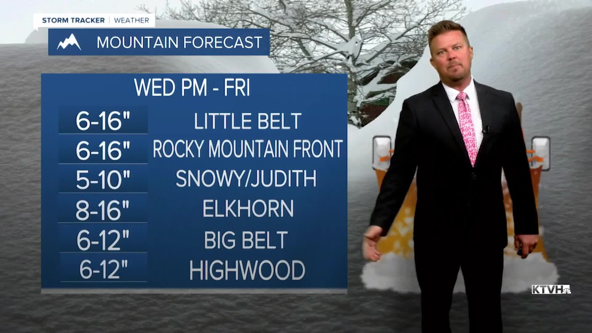
A large, slow moving storm will produce snow and much colder temperatures for most of Montana into the weekend. A variety of weather conditions will be felt across Montana over the next several days, from record warmth and thunderstorms to possible record cold and areas of snow. The storm has already produced rain and thunderstorms, but now snow levels are lowering. Tonight, temperatures will continue to fall through the 40s into the 30s, with cold enough air for rain to change to snow even in the valleys and plains. Thursday will be a winter-like day with snow, wind and cold temperatures. Heavy snow will fall in the mountains, but the lower elevations could pick up several inches as well. Snow will mainly stick on the road surfaces in the mountains, so expect slippery conditions there. There may be slippery and slushy spots in the lower elevations for the next several days. Highs will only be in the 30s to around 40. A strong wind out of the north will make it feel even colder. Overnight lows will drop into the 10s and 20s. Friday will be mostly cloudy with areas of snow and strong wind. Highs again will be in the 30s to near 40. The big storm will slowly move away this weekend but cold air, wind, mostly cloudy skies and snow showers will linger. Cooler temperatures will continue with mixed rain and snow showers in the lower elevations, and mountain snow showers early next week. The unsettled, stormy weather looks to continue into the first week of May. So enjoy the warm weather while we have it!
Have a great day,
Curtis Grevenitz
Chief Meteorologist
