A WINTER STORM WARNING has been issued for Yellowstone Park, the Beartooth Mountains and the Absaroka Mountains.
A WINTER WEATHER ADVISORY has been issued for the Bitterroot and Saphire Mountains.
An AVALANCHE WARNING is in effect for the Madison, Gallatin, Park, Absaroka and Beartooth Mountains.
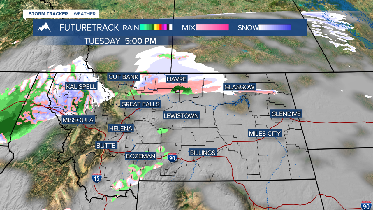
If you're dreaming of a white Christmas, you may have to keep dreaming with just a touch of snow, rain and freezing rain before the holiday. The weather leading into Christmas will be fairly quiet, a welcomed sight after last week's severe wind and other weather. Tuesday will be on the cloudy side with just a few rain and snow showers mainly in the western mountains. Highs will range from the 10s and 20s up on the Hi-Line, to the 30s and 40s elsewhere. Cold air will hold onto the Hi-Line for most of this week. Christmas Eve will be partly to mostly cloudy with an outside chance at a rain or snow shower. Highs will be mild in the 40s for most areas. From about Great Falls north, highs will be in the 10s, 20s and 30s. After about midnight on Christmas Eve into Christmas morning, an area of light rain, some freezing rain, and some snow will move through the state. So when you wake up on Christmas Day there may be a coating of ice and snow, or just wet ground. Christmas Day will turn partly cloudy with mild temperatures in the 30s and 40s. Friday will be mild and mostly cloudy but a strong cold front will dive south from Canada through Friday night into Saturday morning. A period of snow will accompany the front along with colder temperatures. Saturday will turn partly cloudy with highs in the 0s, 10s and 20s north, 30s and 40s south. High pressure will move in on Sunday with mostly sunny skies. At this time, the valleys will likely form inversions and be colder and calm. The plains will see warmer temperatures with stronger wind. This pattern should continue through the beginning of the week.
It's almost Christmas,
Curtis Grevenitz
Chief Meteorologist


