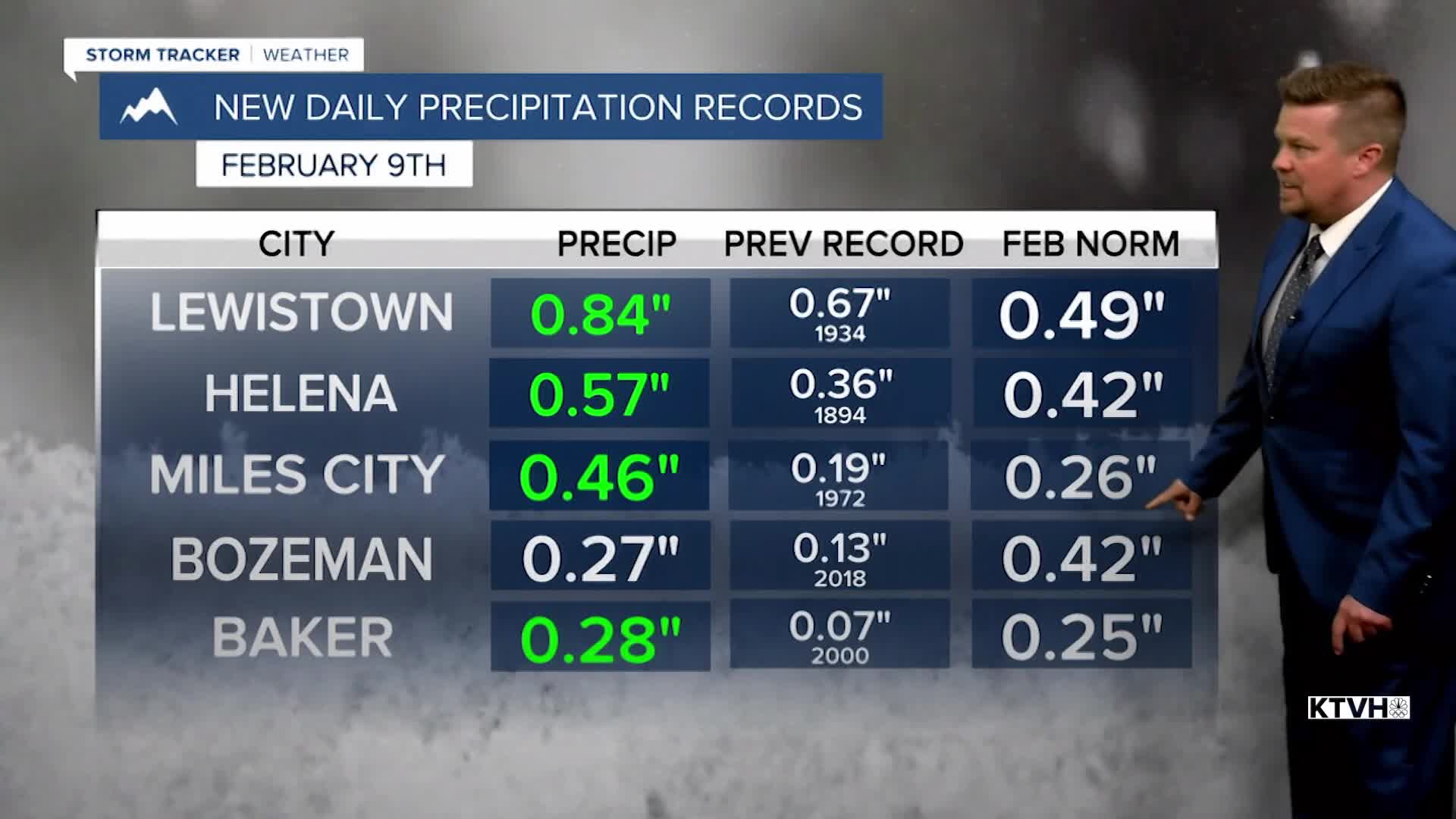


It's looking more like February and winter with more snow on the ground in parts of Montana than there has been in a while. That was a pretty good storm and several Montana cities including Helena, Lewistown, Baker and Miles City received more precipitation from this one storm than typically occurs in the entire month of February. However, the rest of the week will be dry and mild. There will be lots of sunshine over the through the rest of the workweek. Wednesday a little snow will fall in southern Montana along I-90, but most of the rest of the state will be dry with comfortable temperatures and decent sunshine. Thursday and Friday will be partly to mostly sunny with highs in the 40s to near 50. Saturday is Valentine's Day and the weather looks mostly cloudy with highs in the 40s and low 50s with dry conditions. Sunday will be mostly cloudy with an outside chance at a few flakes or drops. Overall most of the state will be dry with highs in the 40s to around 50. Monday is looking mild and dry but starting Tuesday there is a chance of snow and colder temperatures. The pattern next week will be colder with snow moving through the West. Winter is not over yet, but time is winding down.
Have a great day,
Curtis Grevenitz
Chief Meteorologist
