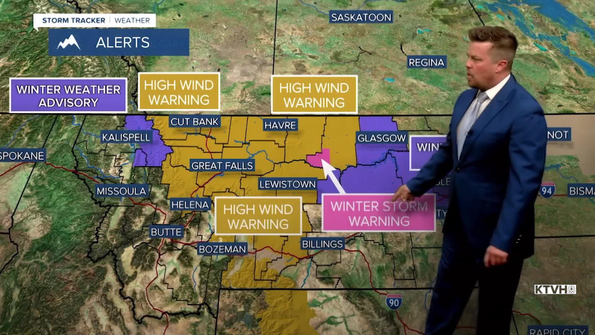


A HIGH WIND WARNING is in effect for parts of Montana into Friday morning.
A WINTER STORM WARNING has been issued for the Little Rocky Mountains for Friday into Saturday morning.
A WINTER WEATHER ADVISORY has been issued for the Glacier area and parts of north-central and eastern Montana through Friday into Saturday morning.
The wind storm will gradually die down but the last snow of February will move in heading into the weekend. Winds will continue to be strong through Thursday night into Friday morning. The wind will slowly ease up on Friday from north to south as a cold front moves down from Canada into northern Montana. Snow will increase up on the Hi-Line through Friday evening. Some snow is possible in or just north of Great Falls and Lewistown, but most of the accumulation through Saturday morning will be up on the Hi-Line and across eastern Montana. Highs on Saturday will range from the 20s north, to the 40s farther south. Sunday will be a mostly sunny day with highs in the 40s and 50s. Sunday is also March 1st and that's the beginning of Meteorological Spring. Monday and Tuesday will be warmer and sunny with highs in the 50s. The next storm will move across the state on Wednesday with a chance of rain and snow showers.
Have a great day,
Curtis Grevenitz
Chief Meteorologist
