


A HIGH WIND WARNING has been issued for most of central and western Montana for Wednesday through Thursday.
A HIGH WIND WATCH has been issued for most of eastern Montana for Thursday.
A WINTER WEATHER ADVISORY is in effect for the Rocky Mountain Front and Glacier area through tonight until 6pm Wednesday.
A WINTER STORM WARNING has been issued for the Rocky Mountain Front and the Glacier area for Wednesday evening through Saturday.
A WINTER STORM WATCH has been issued for parts of central and northern Montana from Thursday through Saturday.
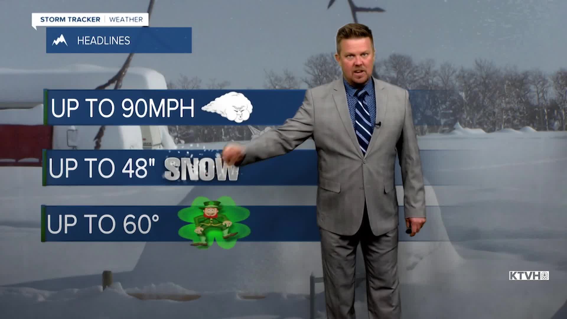
The worst of this storm will produce wind up to 95mph along the Rocky Mountain Front and snow of up to 48" in the mountains. The majority of the state will not see those conditions, but everywhere will have powerful wind and eventually some snow. The atmospheric river is headed from the Pacific straight to Montana and the northern Rockies. Copious amounts of moisture will hit the Treasure State and there will be significant temperature differences and fluctuations. Wind will intensify through Wednesday and be terrible at times with power outages and property damage possible if not likely. The atmospheric river will begin moving in on Wednesday. Most of the state will turn mostly cloudy. Temperatures will slowly warm up with highs in the 40s. The wind will increase through the day, with some gusts topping 50-60mph by late afternoon. There will be heavy snow developing in the mountains and on the Rocky Mountain Front. Downsloping from the Continental Divide should keep areas just east of the Divide drier with just a few showers of rain and snow. Some light snow, possibly mixed with rain is possible across north-central and eastern Montana with little to no accumulation. Temperatures will warm through Wednesday night into Thursday. Thursday will have some highs in the 50s and 60s south, with 30s and 40s north. A cold front will move south with powerful wind and some rain changing to snow through the morning hours. The mountains will continue to see very heavy snow. The atmospheric river will bisect the state on Friday with snow and cold up north, but mild and showery weather farther south. That boundary line looks to set up along Highway 12, with warmer air to the south. Heavy snow will continue in the mountains. A cold front will move south through the state on Friday night into Saturday with all areas picking up snow. Saturday will be a wintry day with highs in the 10s and 20s, and wind blowing around the snow. Several inches will fall in the lower elevations. By this time, several FEET of snow will accumulate in the mountains. This storm will have a significant impact on the state from Wednesday into Sunday. Next week, a major warmup is on the way and temperatures could warm to between 60-70 degrees by St. Patrick's Day. Wild, wild weather.
Stay tuned for the latest on this imminent storm,
Curtis Grevenitz
Chief Meteorologist
