A WINTER WEATHER ADVISORY has been issued parts of western Montana from Friday through Saturday.
A DENSE FOG ADVISORY continues for northeast Montana into Friday morning.
A WIND ADVISORY has been issued for parts of western Montana from Friday into Saturday morning.
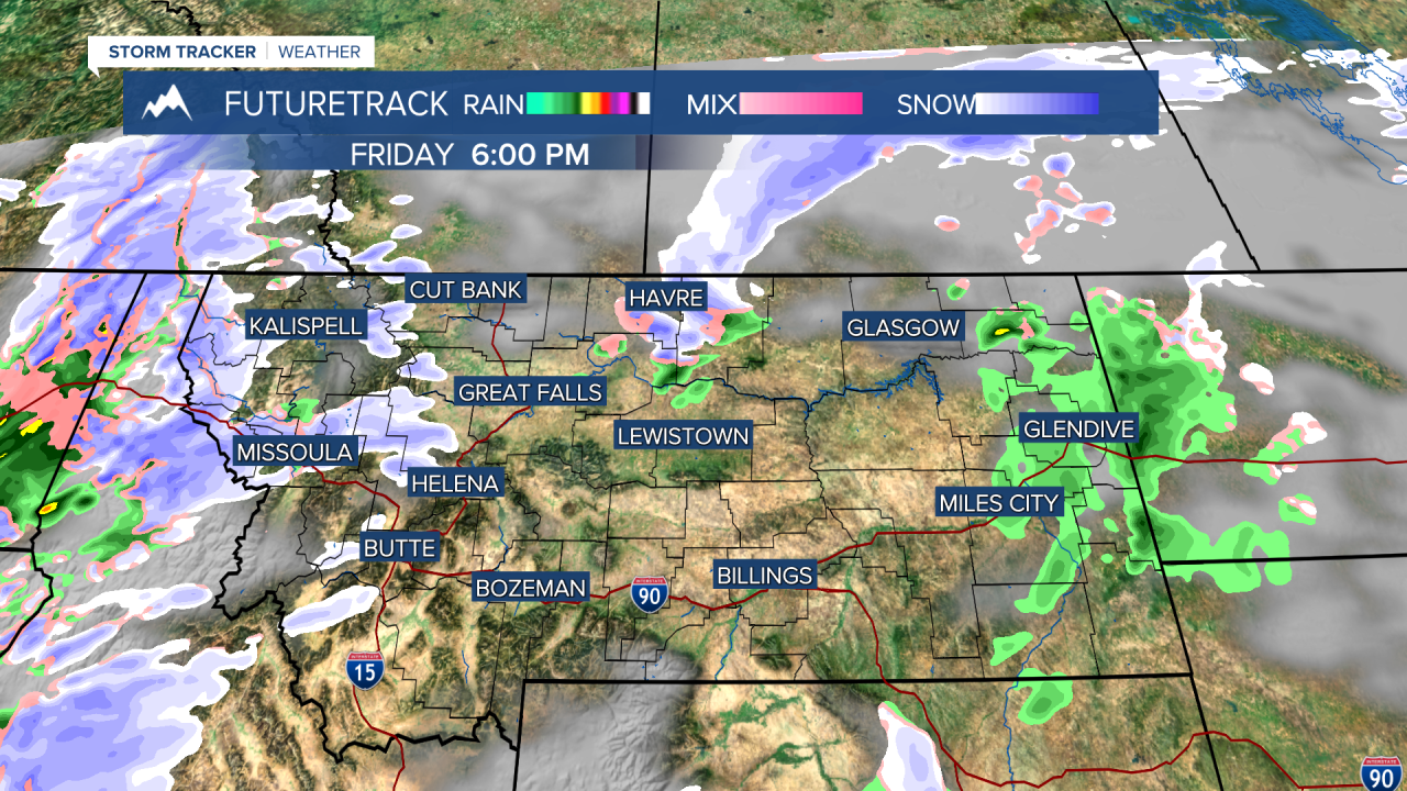
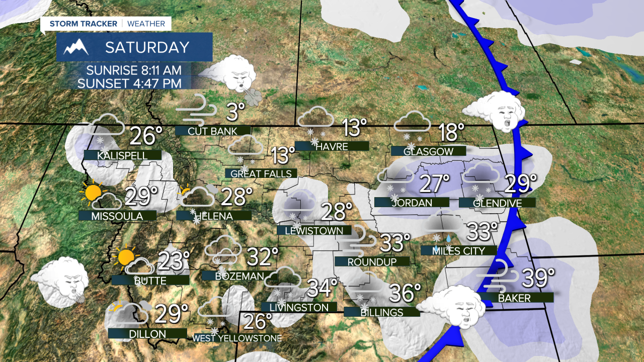
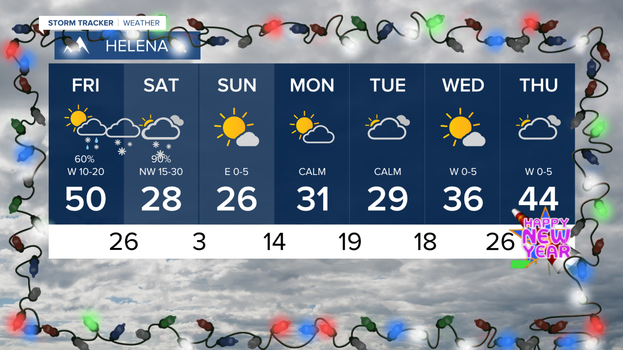
Merry Christmas! While it was warm and sunny for Christmas Day in most places, there's cold and snow headed to Big Sky Country very soon. Friday will be mild again with partly to mostly cloudy skies and scattered rain and snow showers. It will turn windy. A strong cold front will dive south from Canada through Friday night into Saturday morning. A period of snow will accompany the front along with colder temperatures. Saturday will be mostly cloudy with areas of snow, and highs in the 0s and 10s north, 20s and 30s south. Most of Montana will drop into the -0s and 0s Saturday night into Sunday morning. High pressure will move in on Sunday with mostly sunny skies. At this time, the valleys will likely form inversions and be colder and calm. The plains will see warmer temperatures with stronger wind. This pattern should continue through the beginning of the week. The next storm system may not hit until after the start of 2026.
Merry Christmas,
Curtis Grevenitz
Chief Meteorologist


