A FLOOD ADVISORY is in effect for parts of central Montana.
A FLOOD WATCH has been issued for eastern and southern Montana.
A FLOOD WARNING is in effect for the Musselshell River.
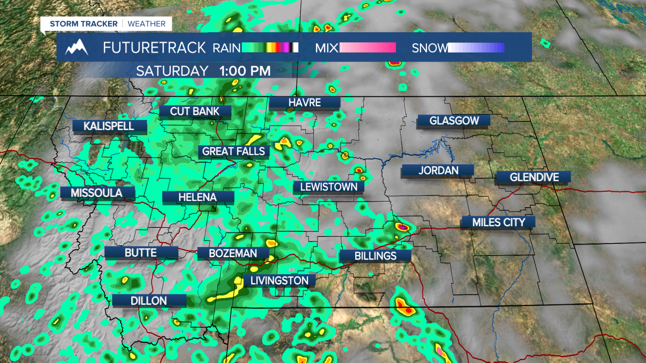
Flooding concerns are real as more of Montana sees heavy rain over water logged ground with a very wet pattern continuing into the middle of June. Rainfall totals over the next 10 days could be as much as 3-6" across much of central Montana. It's been wet and the ground is saturated after all of this recent rain. The rainy weather will continue into the weekend but there will be some sunshine and warmer temperatures late this weekend. Significant rain could lead to areas of flooding which is why parts of the state are under a FLOOD WATCH, ADVISORY or WARNING. Saturday will be cloudy and rainy for central and western areas, with some sunshine and showers breaking up late in the day. Eastern Montana will have more sunshine but that will fuel scattered thunderstorms. Highs will be in the 50s and 60s west and central, 70s across eastern Montana. Sunday will be partly cloudy with scattered to widespread thunderstorms. Another round of wet weather is likely through the beginning of next week. Monday and Tuesday will have widespread showers and thunderstorms, but also partly cloudy skies and warm temperature in the 70s and 80s. Thunderstorms will continue to be scattered through the rest of the week, with another widespread soaking rain possible the second weekend of June. Long range indications are fairly wet weather will continue through the month of June into the beginning of July.
Have a great weekend.
Curtis Grevenitz
Chief Meteorologist


