Happy Monday!
I know a lot of us are feeling the holiday spirit as we finish off this last week in November, however, the weather isn't necessarily in agreement with classical wintertime conditions.
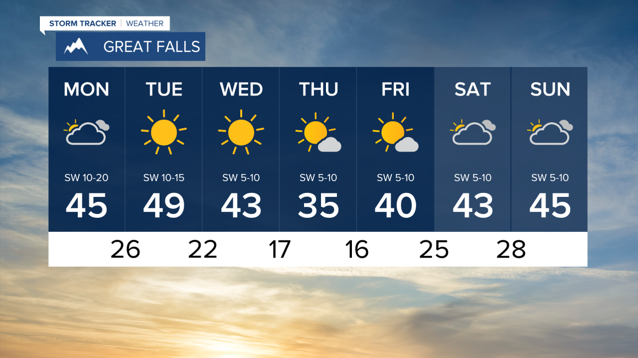
A ridge of high pressure is building over the Northwest taking our temperatures into above normal territory to kick off the workweek. We'll have partly cloudy skies today with highs sitting between the upper-30s to mid-40s throughout Montana. Just a few degrees warmer than normal. Periods of strong wind will develop along the Rocky Mountain Front this afternoon and evening with wind speeds up to 15-20 miles per hour. Gusts up to 30mph are possible. This wind will extend south along the Rocky Mountain corridor towards Livingston as well as east towards the Plains tonight.

We're looking at pleasant weather Tuesday with plenty of sunshine and climbing temperatures. Great Falls is looking at a high of 49 tomorrow which is about 10 degrees warmer than average. Weak disturbances will migrate towards Montana Wednesday which will drop temperatures into the 30s. However, very little precipitation is anticipated.
Confidence is growing for an atmospheric river event to move towards Montana over the weekend which would drop a high amount of moisture. With this system we are looking at snow accumulations towards the higher elevations.


