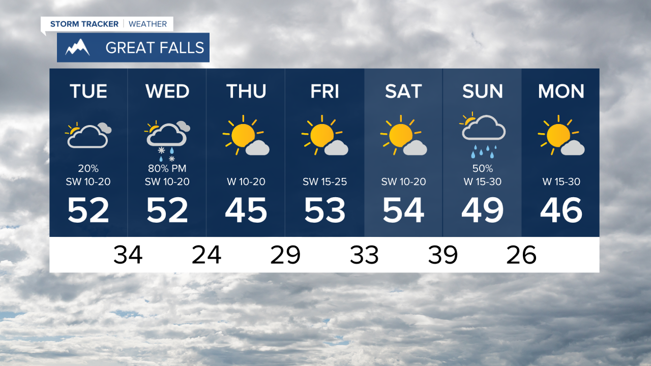
Some isolated, light showers will push through central Montana today, but they will be very low-impact. Helena and Great Falls are both on track to see trace precipitation - possibly virga rain - to the valleys. We will have decreasing cloud cover through the day and variable wind will strengthen this afternoon along the Rocky Mountain front.
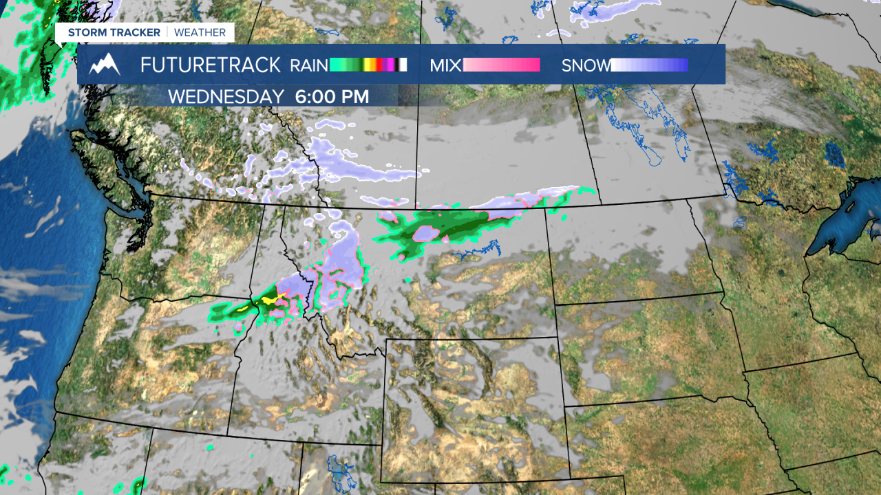
Wednesday, a fast moving weathermaker will bring snow to the higher elevations and a brief cooldown. Be prepared for implications to the roadways tomorrow such as slick conditions and reduced visibility. We could see a dusting of snow to the lower valleys, but due to warmer temperatures we'll likely see rain and rain/snow mix. Higher elevations will accumulate 2-8 inches of snow. A Winter Weather Advisory is in effect for tomorrow in the Kalispell and Polson areas.
Drier and sunnier conditions then settle in to round out the week.