

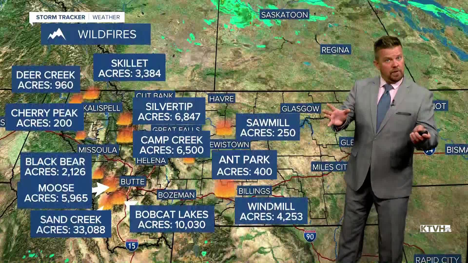


Over the weekend, widespread thunderstorms and lightning strikes were followed by strong wind leading to several new wildfires and several existing fires growing in size. BUT, given the wind, it could have been worse. The Camp Creek Fire in the Bob Marshall Wilderness absolutely blew up on Sunday, burning more than 6,000 acres. It created a smoke plume that extended into Canada and ash fell along the Rocky Mountain Front and parts of north-central Montana, and that fire is active again on Monday with a smoke plume visible over Great Falls. There were several smaller new fires that started, and some existing fires grew by 100-1000 acres. However, many of the active fires did not blow up, and looking ahead this week there will not be any intense heat or wind. Tuesday will be a mostly sunny day with a few isolated thunderstorms over the southwest part of the state. Highs will be in the 70s and 80s with light wind. Wednesday will be similar with mostly sunny skies and a few isolated thunderstorms over the western mountains. Highs will be in the 80s to around 90. Thursday will be partly cloudy with a few more thunderstorms moving east through the afternoon and evening. Highs will be in the 80s to low 90s. Friday will be a pleasant August day with mostly sunny skies and highs in the 80s. This weekend will have a new storm system move into Montana. Saturday will be partly cloudy and warm with scattered thunderstorms in the afternoon. Highs will be in the 80s to around 90. A stronger area of low pressure will move across the state Saturday into Sunday. More widespread showers are possible early on Sunday, and there will be cool enough temperatures for a touch of snow on some of the mountain tops. Highs on Sunday will be in the 60s and 70s. Overall, there are no indications of dangerous heat or wind in the immediate future.
Have a great day,
Curtis Grevenitz
Chief Meteorologist
