

A HEAT ADVISORY remains in effect for much of Montana until Tuesday evening.
A FIRE WEATHER WATCH has been issued for Tuesday afternoon and evening.
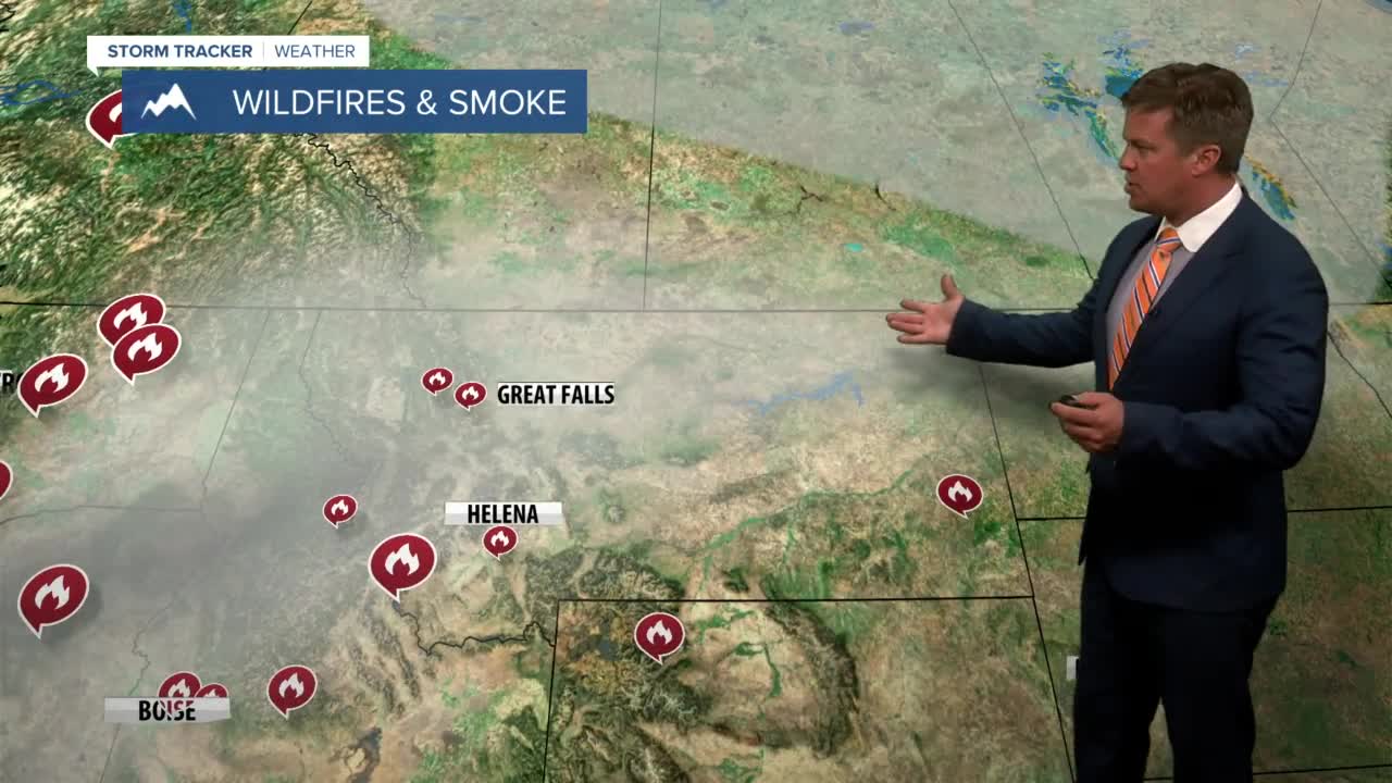
The heat is on. Monday was one of the warmest days of the year. Two new wildfires started, one on the east side of the Swan Range. The other fire southwest of Augusta, growing more than 50 acres with smoke visible from Great Falls. Tuesday will be another dangerous fire weather day, however there will be a few more thunderstorms capable of producing rain. Moisture from a former tropical depression in the Pacific will move into Montana with more cloud cover and scattered storms throughout the day. The cloud cover should help to cool temperatures down a few degrees. There will be rain with the thunderstorms, but also more lightning strikes capable of sparking new fires. Highs will be in the 80s and 90s, but far eastern Montana could eclipse 100. Afternoon wind will become erratic near any storm, adding to the fire danger. Another wave of moisture will come through on Wednesday with scattered storms mainly over southwest Montana. Highs again will be in the 80s and 90s. Thursday will have more scattered thunderstorms which will hold highs down in the 80s. Friday through the weekend, temperatures will warm back up into the 90s with overall dry conditions. Red Flag criteria could be met for dangerous fire weather on Saturday and Sunday. After the weekend, temperatures should cool down some. So once we get through this week, the worst of the summer heat should be in the rearview mirror. However, the fire danger will continue to be high until a few soaking rain storms move in.
Have a great day.
Curtis Grevenitz
