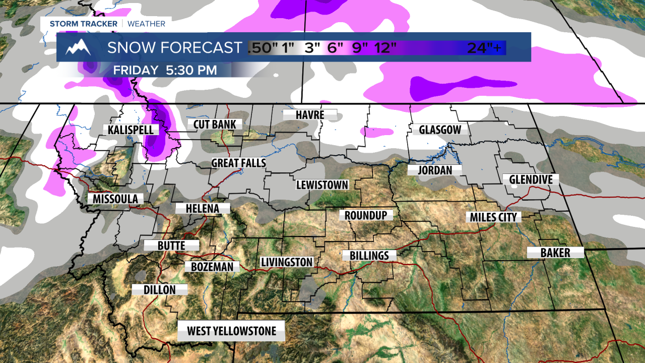
A WINTER WEATHER ADVISORY is in effect for most of eastern and northern Montana, including the Hi-line through Thursday into Friday.
An AVALANCHE WARNING continues for the mountains of northwest Montana.
Wednesday was a sloppy day across most of Montana, with a variety of precipitation types falling across Big Sky Country. A springlike rain fell in Helena and Great Falls out to Lewistown. Farther north there has been freezing rain, sleet and snow on the Hi-Line to the Canadian border. This area will continue to see freezing precipitation into Thursday morning. A cold front bisecting the state is the defining line between the icy weather up north, and the wet/warmer weather in central and southern Montana. Eventually, this front will push south and everyone will see snow. Thursday will start out slippery up north with some lingering freezing rain, sleet, snow and dense fog. Precipitation should diminish through the morning hours. The front bisecting the state will slowly push north along with the colder air. Places like Lewistown and Great Falls will pop into the warm sector for a while in the afternoon. Helena will stay in the warm sector. These locations will have highs in the 50s to near 60 with partly cloudy skies. The Hi-Line should remain on the cold side, with highs there only in the 20s and 30s. Late Thursday evening, the frontal boundary will start sliding south with ice and rain changing to snow through Thursday night into Friday morning. Some areas of snow will continue on Friday with much colder temperatures across the state in the 20s and 30s. Snow will continue for parts of central and southern Montana through Friday night into Saturday. Snow will diminish from north to south through Saturday. Several inches of accumulation are likely. Sunday will be partly to mostly cloudy with scattered snow showers, the mountains should see a few additional inches. Monday will be a partly cloudy day with a break in precipitation. Highs will be close to average in the 30s and 40s. Another round of snow and colder air is likely for Tuesday. In fact, a snowy and colder pattern will settle in through the middle of March.
Curtis Grevenitz
Chief Meteorologist


