A BLIZZARD WARNING has been issued for the Little Belt and Highwood Mountains.
A HIGH WIND WARNING is in effect for most of the state through Tuesday.
A WINTER STORM WARNING has been issued for the Big Snowy Mountains, the Big Belt Mountains, the Rocky Mountain Front and the East Glacier area.
A WINTER WEATHER ADVISORY has been issued for Great Falls, Lewistown, the Bear Paw Mountains, the Sweet Grass Hills, and the higher terrain around Helena.
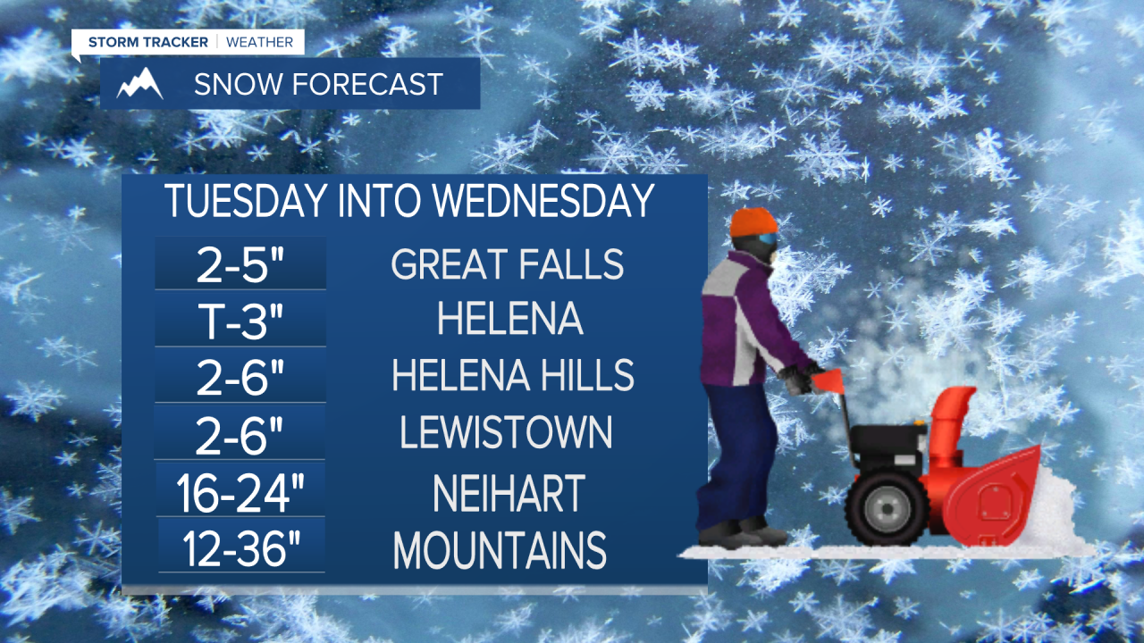
Another major spring storm is already hitting Montana hard with strong wind, but rain and heavy mountain snow will increase through the next few days. Snow levels will drop down to the valleys and plains while some of the mountains could receive their biggest snow totals of the year here in the beginning of May. A late season BLIZZARD WARNING has been issued for the Little Belt and Highwood Mountains as up to 3 feet of snow could fall and get blown around by wind up to 60mph. Rain will increase from east to west on Tuesday. Central and eastern Montana will have moderate to heavy rain with snow in the central mountains. Some rain will move into Great Falls by midday with showers holding off for Helena until much later in the day. Highs will be in the 40s and 50s with wind gusting between 40-60mph for most of the state. Tuesday night the snow levels will drop to the valleys and plains. A few inches of slushy snow could be on the ground by Wednesday morning. Travel conditions from Lewistown to Great Falls to Helena and up the Rocky Mountain Front will be sloppy and difficult early in the day. Travel will be extremely difficult to impossible around the Little Belt and Highwood Mountains on Wednesday as blizzard conditions continue. Temperatures early in the day will be in the 20s and 30s allowing the snow to stick. By the afternoon, readings will warm up into the 40s in the lower elevations and the snow will mix with and turn to rain. Precipitation intensity will decrease by the afternoon and evening. Between the rain, snow and wind, Wednesday will be a very stormy day with difficult conditions to travel or just be outside in. The storm will start pulling away on Thursday with partly cloudy skies and a few showers in the lower elevations, a couple snow showers in the mountains. Highs will warm into the 50s and 60s. The wind will be much lighter, around 5-15mph. After all of this storminess, who else could use some warmth and sunshine? Our fortunes will change beginning on Friday with mostly sunny skies and highs in the 60s and 70s. The weekend will be gorgeous with much warmer temperatures in the 70s under mostly sunny skies. A drier and warmer pattern will persist through most of next week. There is light at the end of the tunnel.
Curtis Grevenitz
Chief Meteorologist


