

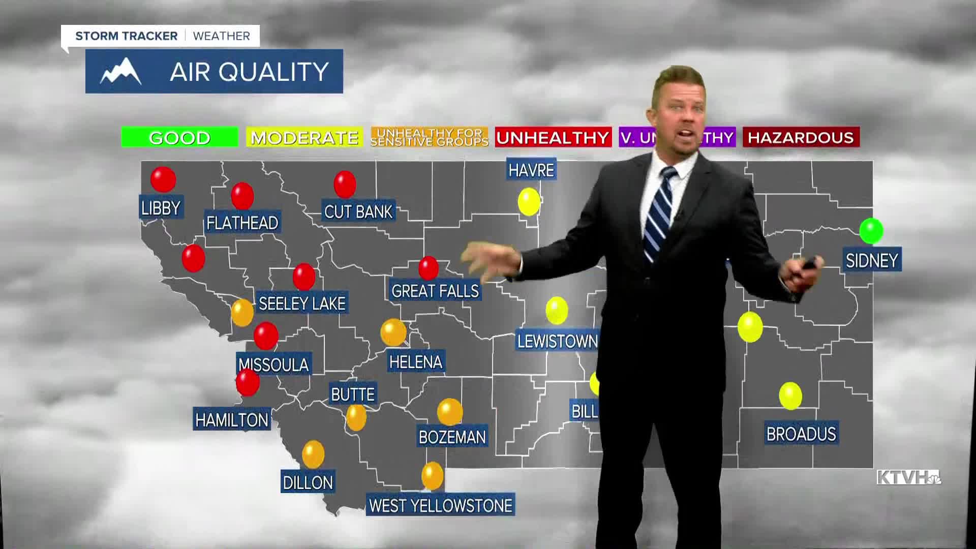


An AIR QUALITY ALERT is in effect for most of western Montana.
A hot, smoky and fiery start to August will get some relief as cooler, cleaner air with some rain is headed to Montana this week. Montana's wildfires continue to burn, grow, and emit smoke. Other larger fires in Washington and Oregon continue to burn and contribute smoke to our skies. The farther west you go in Montana, closer to the fires, the worse the air quality is. A cold front will move down from Canada later this week with much cooler temperatures, some cleaner air, and a good chance at some wet weather. Tuesday will be one more hot, dry and smoky day. The air quality will be an issue again, and temperatures will top out in the 80s to near 90. Changes start on Wednesday. A cold front will drop south out of Canada with a decrease in temperature and an increase in cloud cover. A few isolated showers and thunderstorms will develop through the day. Highs will range from the 60s and 70s north, to the 80s farther south. The air quality should see a little improvement. Thursday will be a mostly cloudy day with widespread showers and thunderstorms. Highs will be as cool as the 50s around East Glacier, the rest of the state will be in the 60s and 70s. Areas of rain and rumbles will continue through the night into Friday. Friday will be a rainy day for most northern and eastern areas of Montana. The rest of the state will be partly to mostly cloudy with a few showers and isolated thunderstorms. The rain, cooler temperatures and higher humidity will help to slow some of the fires. While there will be lightning strikes, the wind does not look especially strong following the storms. This weekend will be partly cloudy and warmer with just a few isolated thunderstorms. Highs will climb back into the 70s and 80s. This rain likely will not put out the fires. The smoke will not completely go away. But, a few days of cooler, wetter weather in the middle of August will be a welcome sight for Montana.
Have a great day,
Curtis Grevenitz
