



A DENSE FOG ADVISORY has been issued for most of north-central Montana and the valleys of western and southwestern Montana through Tuesday morning.
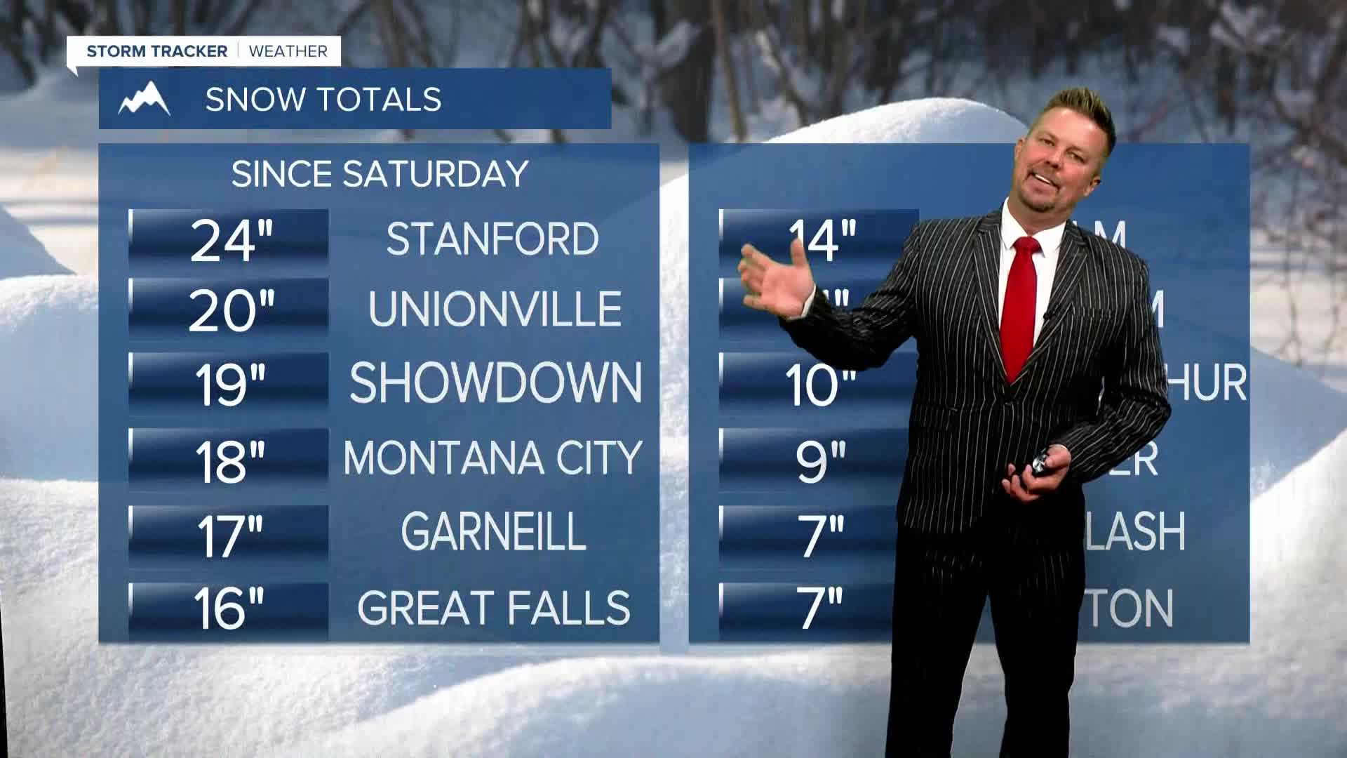
The record-breaking snowstorm over the weekend is over. There's still a lot to dig out from and to clean up, but that storm is now literally history. It snows in October in Montana some years, but not like this. The heavy, wet snow created a lot of weight on trees with leaves still on them. Many, many trees in the state succumbed to the weight. The snow is over, the breaking of branches and trees is now over too. However, there's a lot of moisture leftover that will produce areas of dense fog through Tuesday morning. And with temperatures below the freezing point, it will be slippery and icy in some areas. Fog will be slow to burn off in the valleys, but the rest of the state will be warmer, sunny and dry. Highs will top out in the 40s and 50s, with more snow melting. Tuesday night, more fog will develop but gradually burn off through Wednesday morning. Wednesday will become partly cloudy with highs in the 50s. More melting.... A weak, little cold front will move through the state on Thursday morning without any precipitation. It will be slightly cooler for most of the state, and eastern Montana will be windy. Highs will be in the 50s. Friday, a warm chinook wind will develop and any lingering snow should melt as temperatures warm into the 60s to near 70. This coming weekend will be very different than last as temperatures warm into the 60s and 70s with a strong wind across the plains, Continental Divide and off the Rocky Mountain Front. The next storm to hit Montana with a little rain and higher elevation snow likely comes in on Tuesday.
Enjoy the warmup and melting!
Curtis Grevenitz
Chief Meteorologist
