


A FLOOD WARNING continues for the Mission and Swan Mountains.
A FLOOD WATCH continues for the West Glacier area.
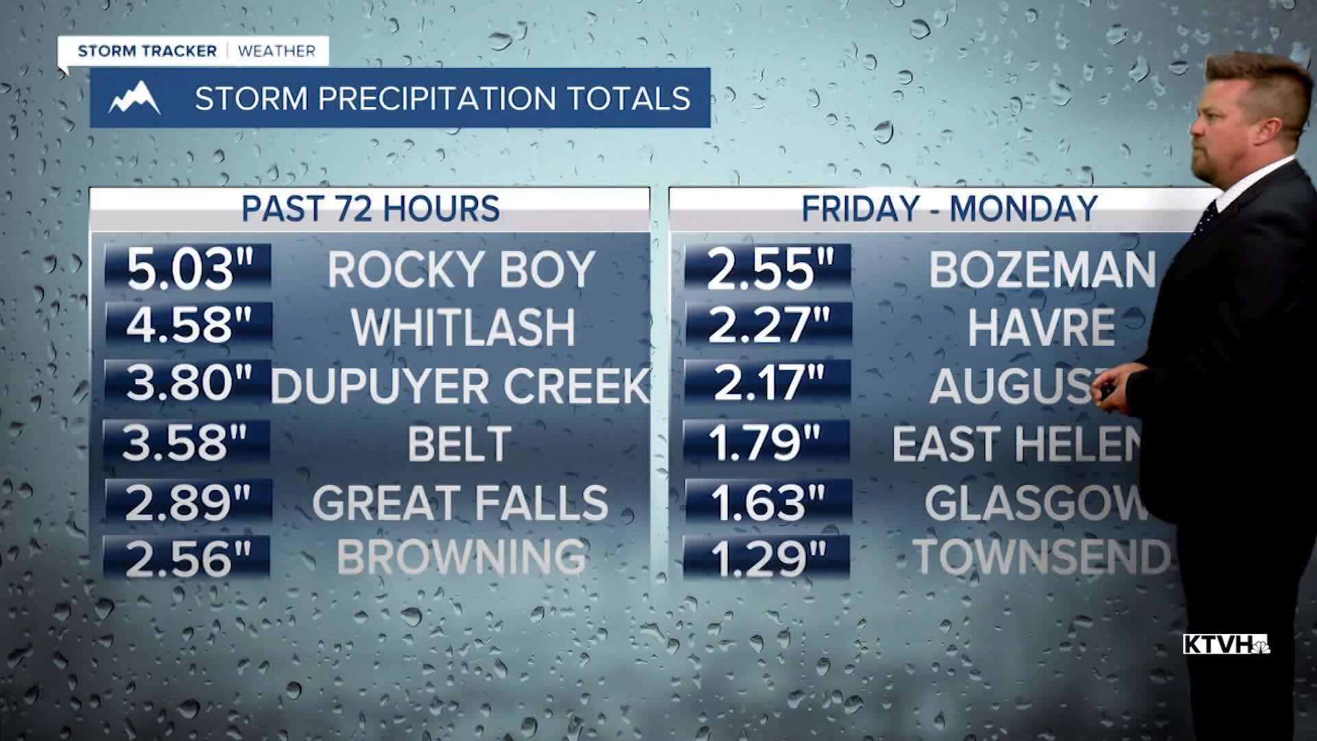
A record breaking rainstorm that produced one of the wettest weekends in recent memory continues with more rain through Tuesday. Widespread rainfall totals of 1-3" were seen across Montana, with some areas exceeding 4-5" of rain. Perhaps it was a blessing in disguise to have a dry spring up to this point, which reduced the flood potential. Regardless, the ground is saturated and the creeks, streams and rivers are and will be running high the next several days. The big area of low pressure that brought all the rain continues to create clouds, rain and high mountain snow through tonight. Tuesday will be one last wet day from this storm with overcast to mostly cloudy skies and continued rain and showers for most of central and northern Montana. Highs will range from the 40s and 50s north and central, to the 60s farther south near I-90. Additional rainfall amounts will be in the .10"-.50" range. Clouds should break up somewhat before sunset. Wednesday will be a much drier day with partly cloudy skies. There still will be a few lingering showers up on the Hi-Line but most of the state will be dry. Highs will warm into the 60s to around 70. Wednesday night another storm system will move in with scattered showers and a few thunderstorms through Thursday. Rainfall amounts should be less than 0.50". Skies will be partly to mostly cloudy with highs in the 60s to about 70. Friday will be the nicest day in a while with mostly sunny skies and highs in the 70s and 80s. There will be a few scattered thunderstorms around the state this coming weekend, but nothing like this last weekend.
Happy June!
Curtis Grevenitz
Chief Meteorologist
