


A HIGH WIND WATCH has been issued for much of central and eastern Montana for Thursday into Thursday night.
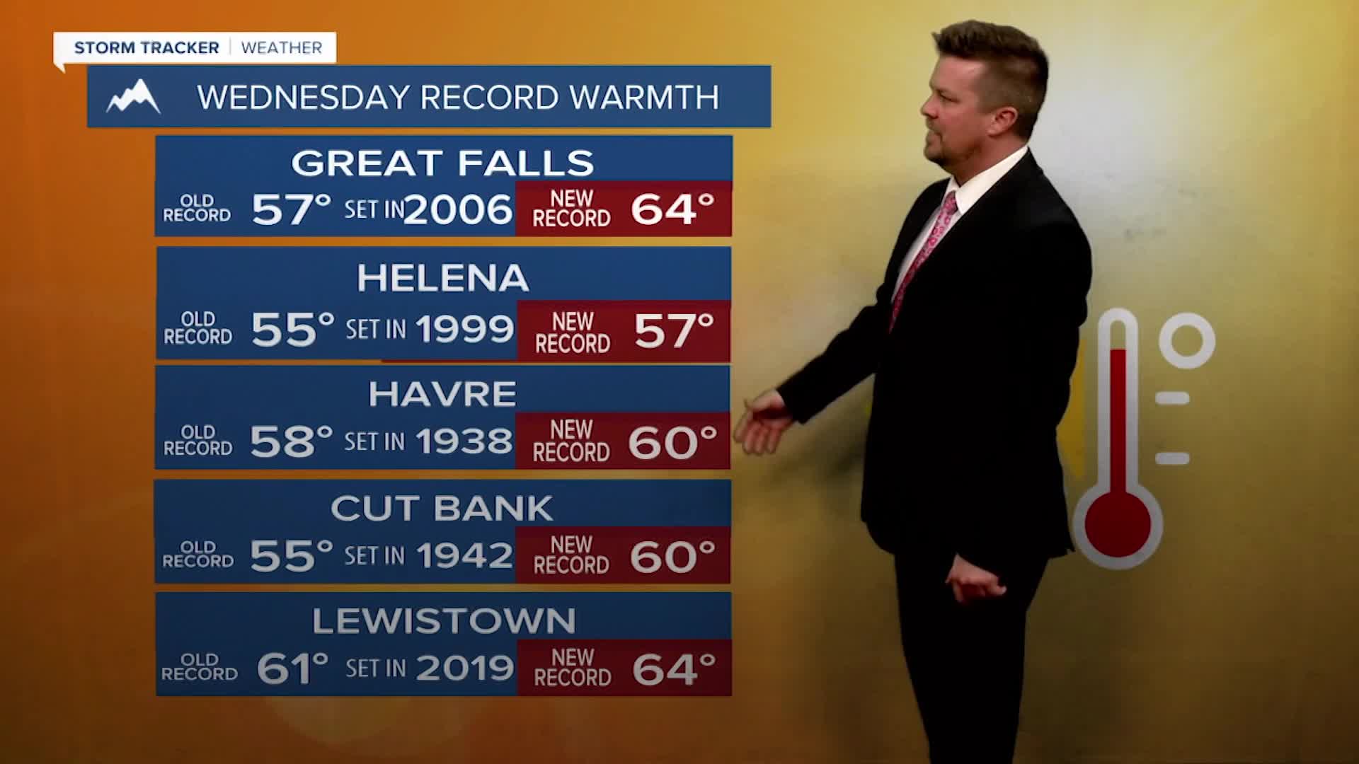
Wednesday WOW! Record highs were set across much of Montana as highs soared well above average into the 50s and 60s. Fort Benton even hit 70! A big ridge of high pressure across western North America has delivered unusual warm and dry conditions across much of Montana. Much of the West has been warm and dry so far this winter. However, there are indications of more typical January weather returning by late next week. And after Wednesday's records, the temperatures will cool back closer to average starting Thursday. Wednesday will start out mostly sunny with a strong wind across the plains. Highs will A weak cold front will move through the state on Thursday. Skies will be partly cloudy and it will turn windy and somewhat colder. A couple of snow showers are possible along the front with little to no accumulation. Highs will range from the 30s in northeast Montana to the 40s farther south and west. The combination of strong wind and colder temperatures will be felt more across the eastern part of the state. High pressure will move in for Friday with mostly sunny and slightly cooler highs in the 20s to near 40. It's likely that most of Montana will be mostly sunny, closer to average temperatures, with wind across the plains through Martin Luther King Jr. holiday weekend. It is possible that a return to more typical snowy and cold weather will occur later next week around January 22nd or 23rd.
Have a great day,
Curtis Grevenitz
Chief Meteorologist
