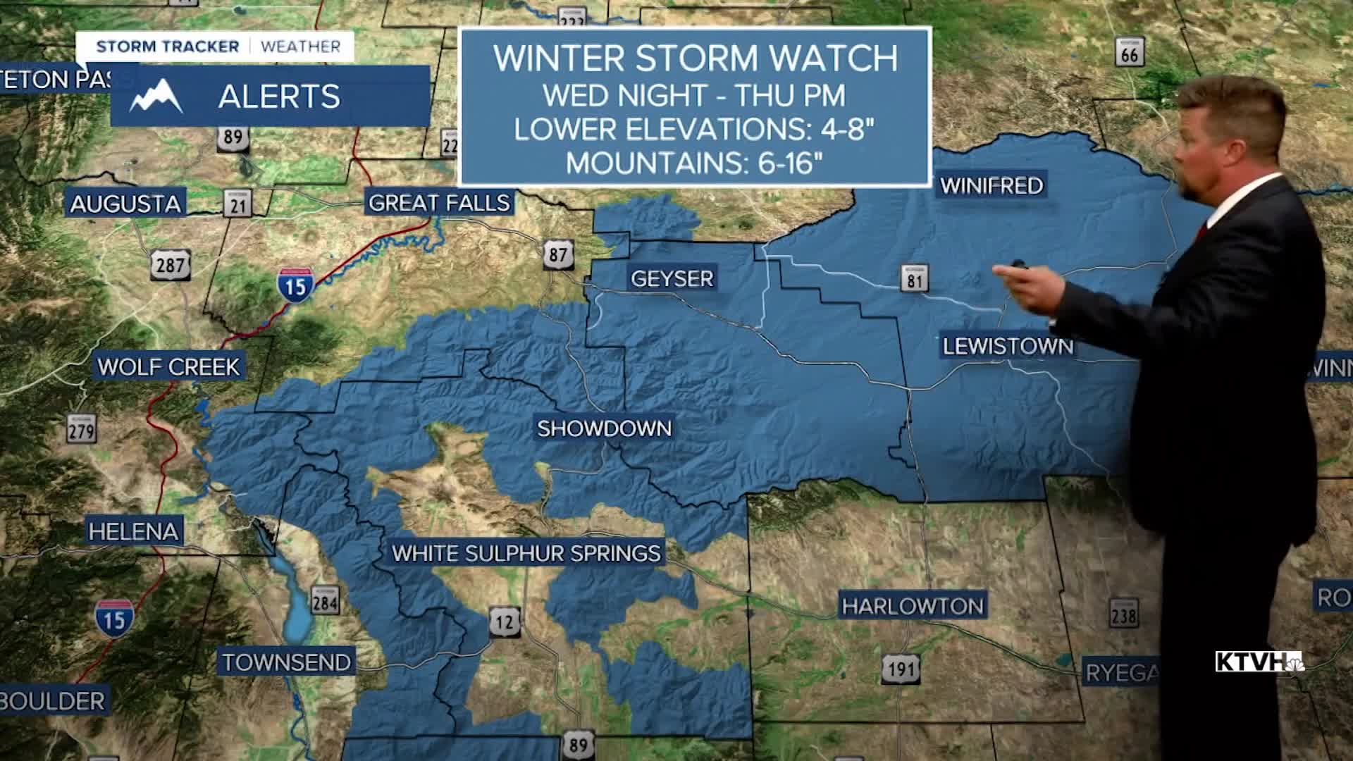


A WINTER STORM WATCH has been issued for parts of central and southern Montana for Wednesday night through Thursday.
Wild whiplash weather in Montana as temperatures will likely be the warmest so far this year on Tuesday, followed by a big drop in temperatures and a drop in snow levels later in the week. Some new record highs are possible on Tuesday as temperatures soar into the 70s and 80s. A big spring storm will move into the state on Wednesday with showers and thunderstorms, and a strong cold front that will bring temperatures tumbling down. Highs will still be in the 80s across eastern Montana, but the 60s and 70s elsewhere. After dark the temperatures will fall through the 40s into the 30s, with cold enough air for rain to change to snow even in the valleys and plains. Thursday will be a winter-like day with snow, wind and cold temperatures. Heavy snow will fall in the mountains, but the lower elevations could pick up several inches as well. Highs will only be in the 30s to around 40. A strong wind out of the north will make it feel even colder. Overnight lows will drop into the 10s and 20s. Friday will be mostly cloudy with areas of snow and strong wind. Highs again will be in the 30s to near 40. The big storm will slowly move away this weekend but cold air and snow showers will linger. Cooler temperatures will continue with mixed rain and snow showers in the lower elevations, and mountain snow showers early next week. The unsettled, stormy weather looks to continue into the first week of May. So enjoy the warm weather while we have it!
Have a great day,
Curtis Grevenitz
Chief Meteorologist
