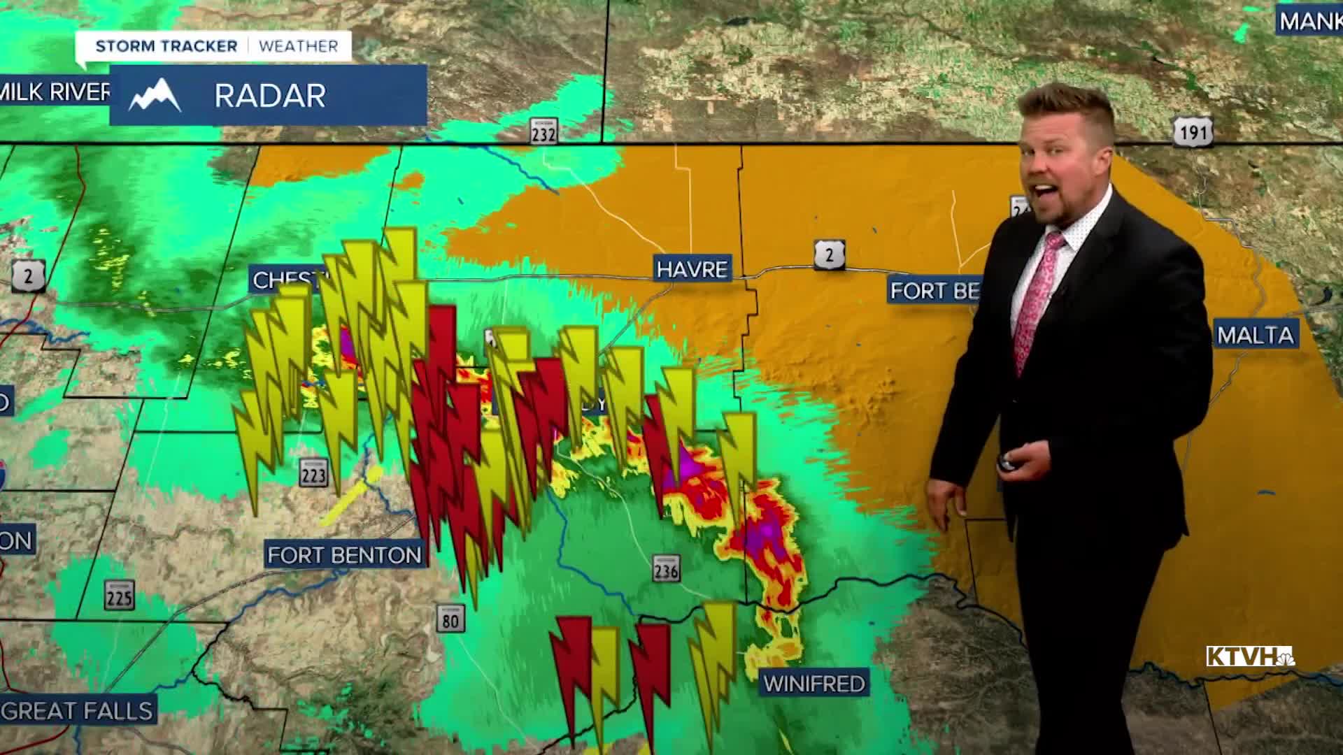


SEVERE THUNDERSTORM WATCH continues until 9pm.
A HIGH WIND WARNING has been issued for much of Montana for Wednesday night through Thursday.
A WINTER WEATHER ADVISORY has been issued for the Glacier region for Wednesday night into Thursday.
Severe thunderstorms have hit many towns in Montana with heavy rain, damaging wind and some hail, and this storm system will continue to impact the state through Thursday. Scattered strong to severe thunderstorms will continue through Wednesday evening. Some heavy rain will accompany the storms. The most likely severe component will be strong, damaging wind with the storms. A powerful cold front will move through the state Wednesday night into Thursday. There will be more thunderstorms, rain, mountain snow, and strong wind. Thursday will be partly to mostly sunny with some morning showersup on the Hi-Line, but the wind will be vicious the entire day. Some gusts could top 60-85mph. Highs will be in the 50s and 60s. Friday will be partly cloudy with an isolated shower or thunderstorm in the lower elevations, and a few snow showers in the mountains. Highs will be in the 50s and 60s. This weekend will be a little more unsettled than last, with partly cloudy to mostly cloudy skies and scattered showers and thunderstorms on Saturday. Some snow showers are likely in the mountains. Highs will be in 50s and 60s. Sunday will be unsettled with mostly cloudy skies, scattered showers and mountain snow showers. Snow levels could drop below 5000'. Highs will be in the 40s and 50s. Active weather will continue next week into Memorial Day Weekend, typical for this time of year.
Be safe out there,
Curtis Grevenitz
Chief Meteorologist
