


A RED FLAG WARNING has been issued for Wednesday for parts of southwest, northern and northeast Montana for dangerous fire weather conditions.
A HIGH WIND WATCH has been issued for much of Montana for Wednesday night into Thursday afternoon.
A WINTER WEATHER ADVISORY has been issued for the Glacier region for Wednesday night into Thursday.
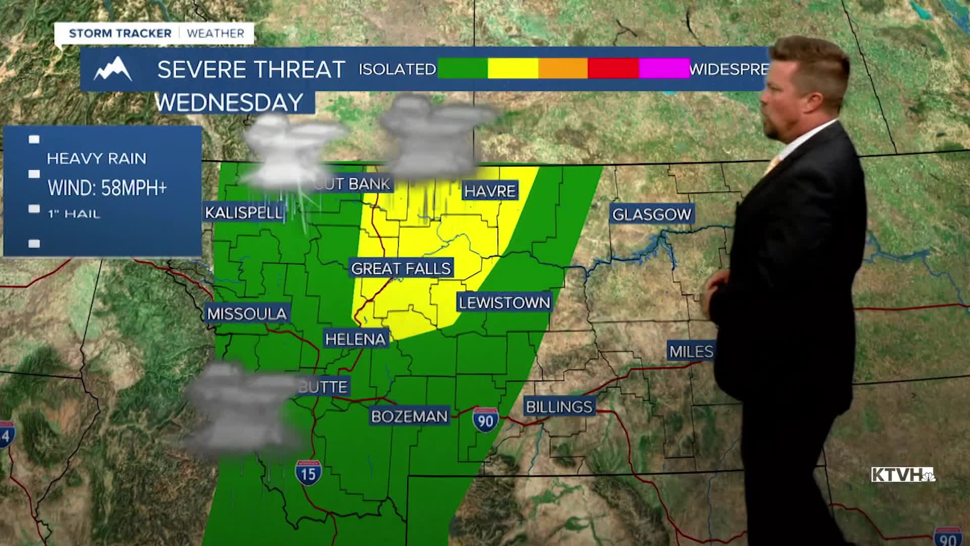
The first significant severe thunderstorm outbreak of the year is likely on Wednesday with some storms producing heavy rain, violent wind and large hail. After a beautiful stretch of warm, sunny and dry weather, the activity is about to increase and the temperatures decrease as the pattern changes. Wednesday will start out warm and dry but it will not end that way. High temperatures will reach the 80s to even around 90 in eastern Montana. That heat will fuel thunderstorms as a low pressure system moves into Montana. There is the likelihood of strong to severe thunderstorms developing Wednesday afternoon. Some of the storms could have large hail and damaging wind. Please keep an eye to the sky if you are outside. The powerful, potentially destructive storms will continue through the evening. A strong cold front will move through the state on Wednesday night into Thursday. There will be more thunderstorms, rain, mountain snow, and strong wind. Thursday will be partly to mostly cloudy with some showers and higher mountain snow, but the wind will be vicious the entire day. Some gusts could top 60-75mph. Highs will be in the 50s and 60s. Friday will be partly cloudy with an isolated shower or thunderstorm, highs will be in the 60s to near 70. This weekend will be a little more unsettled than last, with partly cloudy skies and isolated showers on Saturday. Some snow showers are likely in the mountains. Highs will be in 50s and 60s. Sunday will be unsettled with mostly cloudy skies, scattered showers and mountain snow showers. Snow levels could drop below 5000'. Highs will be in the 40s and 50s.
Stay tuned for the latest on this approaching storm,
Curtis Grevenitz
Chief Meteorologist
