

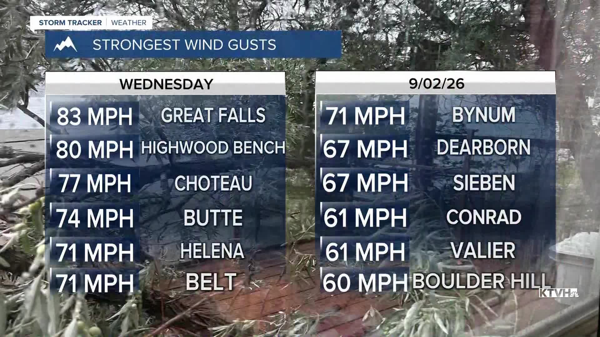


Severe thunderstorms blasted across parts of Montana on Wednesday with extreme wind that caused extensive damage as trees, powerlines and building structures were damaged. The worst of these storms have moved out of Montana, but a large storm system will continue to impact the state for the rest of the workweek and through Labor Day Weekend. Thursday will be a cooler day with highs in the 60s and 70s in western and central Montana, a few 80s farther east. There will be partly cloudy to mostly skies west, more sunshine east. A few showers will move over and near the mountains. There will be a touch of snow in the highest elevations. Some showers and thunderstorms will come down off the Continental Divide and the Rocky Mountain Front in the afternoon and evening, working across I-15. Friday is "getaway day" ahead of Labor Day weekend. Most of eastern Montana will be mostly sunny but the western part of the state will be partly to mostly cloudy with scattered showers and thunderstorms Highs will be in the 60s and 70s west with a few 80s and even 90s farther east. Labor Day weekend won't be the best as there will be some scattered showers and thunderstorms on Saturday. Saturday might be the nicest day with partly cloudy skies and a few of those thunderstorms in western Montana. If you want summer sun and warmth, go to eastern Montana where highs will top out in the 80s and 90s. Sunday the storms will start to increase through the afternoon. Some severe storms are possible up on the Hi-Line. Highs will be in the 60s west, 80s and 90s east. Unfortunately, Labor Day Monday looks like a washout with widespread rain. Temperatures will be in the 50s and 60s in the damp conditions. Labor Day looks like the worst weather in an unsettled weekend.
Have a great day,
Curtis Grevenitz
Chief Meteorologist
