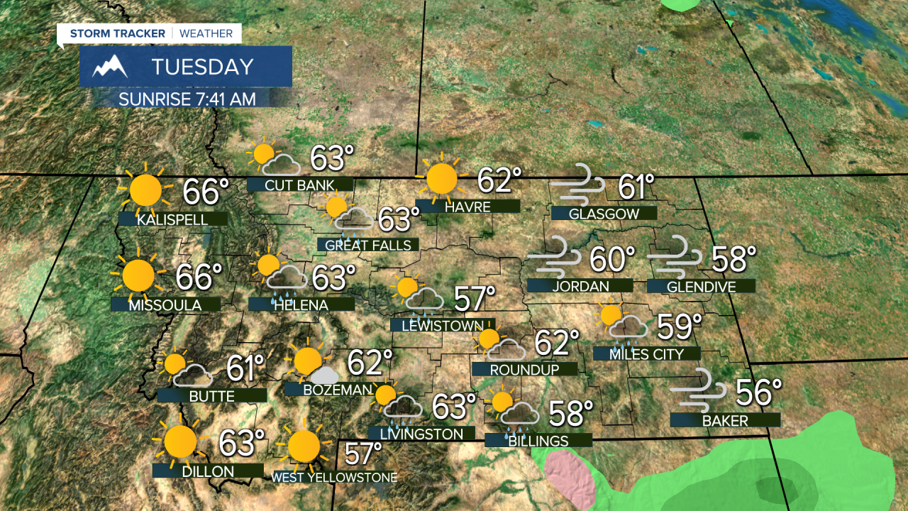
A swift moving cold front will affect the state tonight through Tuesday morning with some showers and higher elevation snow. Another front with some light showers are likely again this Saturday. These are really the only two stormy days you can expect this week. There will be a little more wind as well, which may take some of the leaves off of the trees. Otherwise, there is more pleasant fall weather on tap for much of the state.
This cold front will move quickly through the state with showers, a few isolated thunderstorms and some higher elevation snow above about 7000 feet. If you sleep a little later on Tuesday morning, you might miss the storm completely. By mid to late morning, most of the showers and clouds will be pushing through and out of southern Montana on their way to Wyoming. It will be breezy and cool behind the front with highs in the 50s and 60s. Wednesday the weather will return to more sunshine with highs close to average in the 60s. Another mild and dry stretch will continue through Thursday and Friday. Highs will be in the 60s and low 70s under mostly sunny skies. The weekend will start off unsettled with mostly cloudy skies and scattered showers on Saturday. There will be a little higher elevation snow as well. Highs will cool into the 50s in the lower elevations, but 30s and 40s in the mountains. Sunday will salvage the weekend with a return of sunshine and highs back up in the 60s to around 70. Dry, sunny and warm weather will continue into the middle of next week. Longer range, some stormy and colder weather is likely for the last 10-12 days of October.
Have a great day!
Curtis Grevenitz
Chief Meteorologist


Posted
and last updated


