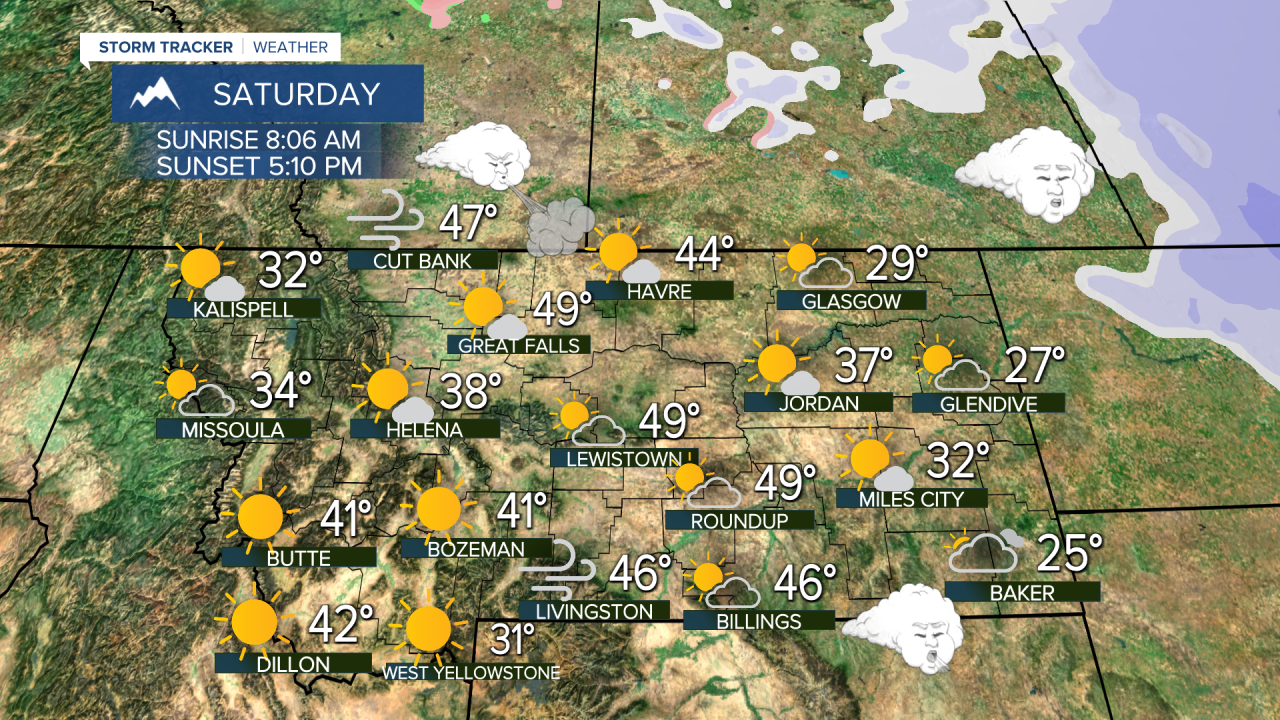
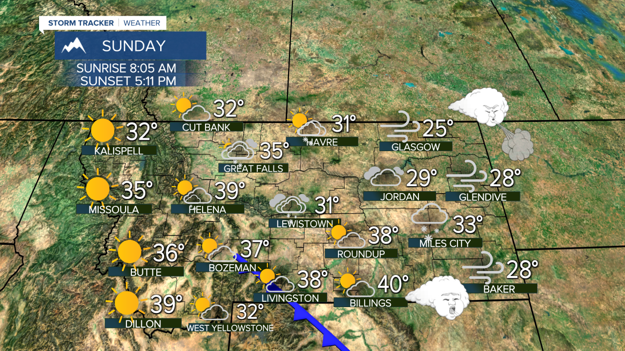
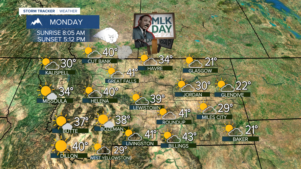
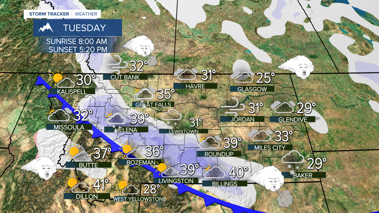
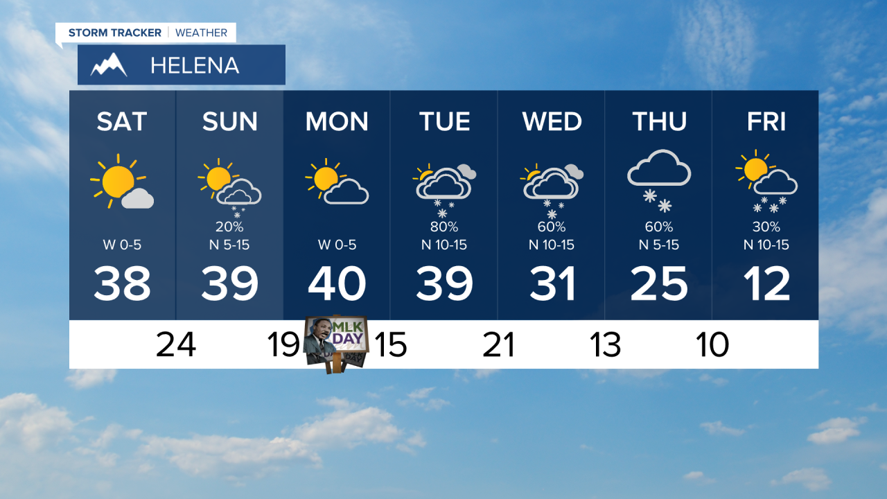
After a spell of unusually warm and dry conditions, more typical weather for this time of year is returning to Big Sky Country. Over the next several days, temperatures will be closer to average but exceptional cold and significant snow will still be absent. That will likely come late next week. Saturday will be slightly warmer across the plains with a brief chinook wind developing. Highs will be in the 30s and 40s under mostly sunny skies. Sunday will be partly to mostly cloudy as another weak cold front moves through the state. Highs will dip back down into the 20s and 30s with a few isolated snow showers mainly over the mountains. Monday will be mostly sunny with highs in the 30s to near 40. Another front will move through on Tuesday with mostly cloudy skies and scattered snow showers producing a light accumulation. A series of cold fronts will come through the state late next week with more snow and colder temperatures. Right now, the snow does not look terribly heavy but should accumulate a few inches. Temperatures will get colder and colder, with the final weekend of January possibly having temperatures well below 0.
Have a great weekend,
Curtis Grevenitz
Chief Meteorologist

