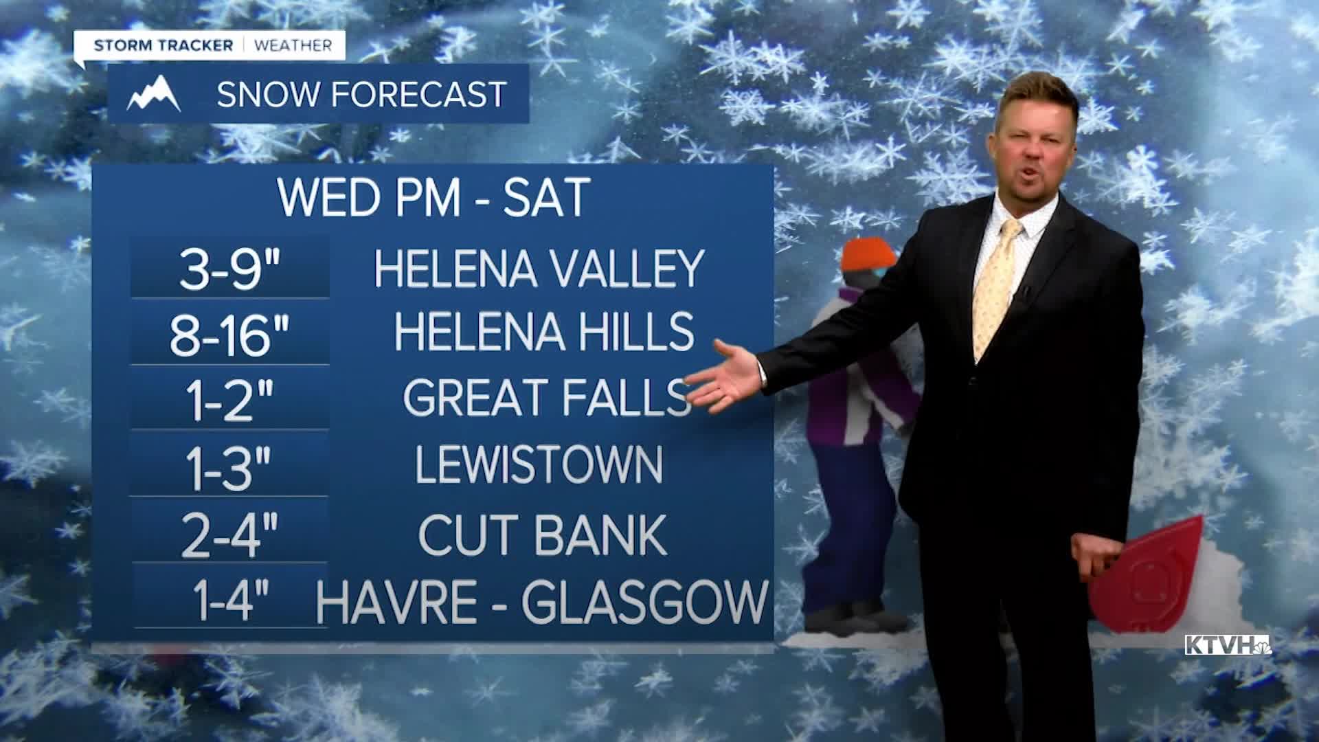


A WINTER STORM WARNING has been issued areas around the Bear Paw Mountains from Thursday night into Saturday.
A WINTER WEATHER ADVISORY has been issued for the Continental Divide, Rocky Mountain Front, East Glacier Area, Bear Paw Mountains, Little Rocky Mountains, both sides of the Divide, including Helena and Great Falls into Friday.
A WINTER WEATHER ADVISORY has been issued for the Hi-Line from Thursday night into Saturday.
Snow fell across the state as a cold late April storm moved in. Cold and snow will stick around for the next few days through the weekend, and more accumulation is likely. The mountains could receive a significant amount of snow, while the lower elevations could see another few inches. This storm really is favoring the Continental Divide, but snow will develop for most of central and northern Montana through the night into Friday. Overnight lows will drop into the 10s and 20s, cold enough for the snow to stick on some roads. Friday will be mostly cloudy with areas of snow and strong wind. Highs again will be in the 30s to near 40, the mountains will have highs in the 20s. The big storm will slowly move away this weekend but cold air, wind, mostly cloudy skies and snow showers will linger. Saturday will be partly to mostly cloudy with scattered snow showers. Highs will top out in the 30s and 40s. Sunday will be mostly cloudy to overcast with more widespread light snow and another light accumulation possible. Highs will be slightly cooler in the 30s to near 40. Cool temperatures will continue with mixed rain and snow showers in the lower elevations, and mountain snow showers early next week. The unsettled, stormy weather looks to continue into the first week of May. Below average temperatures and above average moisture will continue.
Have a great day,
Curtis Grevenitz
Chief Meteorologist
