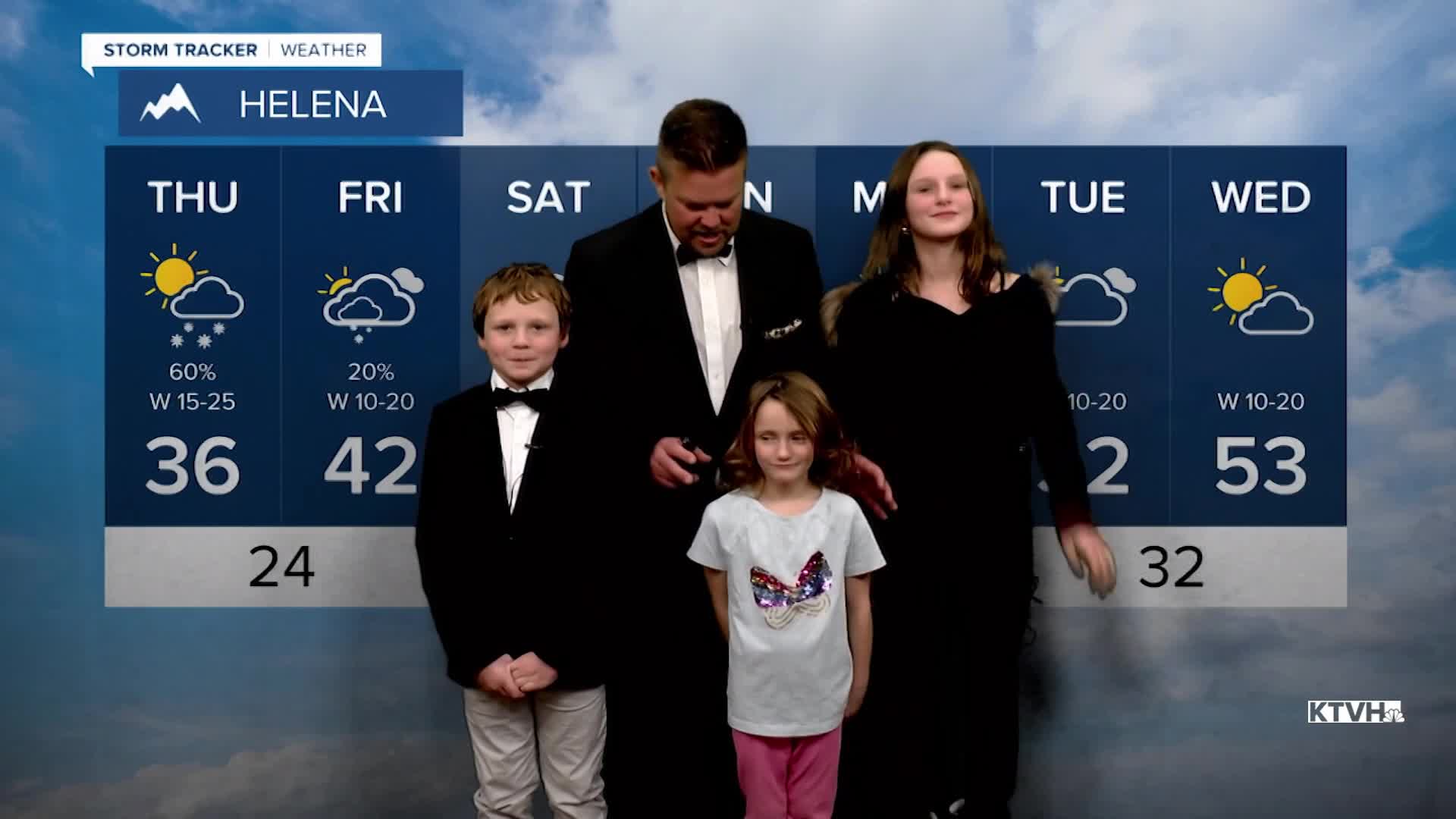


Heavy snow showers and even thundersnow accompanied a front that moved across Montana on Wednesday, and another system will move through the state on Thursday. While it seems to some that there is no snow, and there's not much in the lower elevations, most of the mountain snowpack in Montana is above average. The mountains will continue to add to the snowpack through Friday. Thursday will be partly cloudy, windy, with snow showers mainly in the mountains. A few heavy snow showers could once again move through the Helena area. Travel over mountain passes will likely have snow on the road surface with the possibility of heavy snow showers on and off. Temperatures will be close to normal. Friday will be mostly cloudy with strong wind across the plains. There will be snow on the Continental Divide, the Rocky Mountain Front, the Big Belt and the Little Belt Mountains. Up to another couple inches is possible. Highs will be in the 20s and 30s, with a few spots in the plains hitting the low 40s. This weekend will be partly to mostly cloudy with temperatures again turning milder. Highs will reach the 40s and 50s across some of the plains, 30s to around 40 in the valleys, and 20s and 30s in the mountains. The wind will be strong over the Continental Divide and the plains. Late next week the temperatures will drop along with a chance at snow. The second half of January should be much colder than the first half.
Have a nice day,
Curtis Grevenitz
Chief Meteorologist
