


A HIGH WIND WARNING has been issued for the Rocky Mountain Front and parts of central Montana through the evening.
An AVALANCHE WARNING has been issued for the mountains of northwest Montana into Thursday.
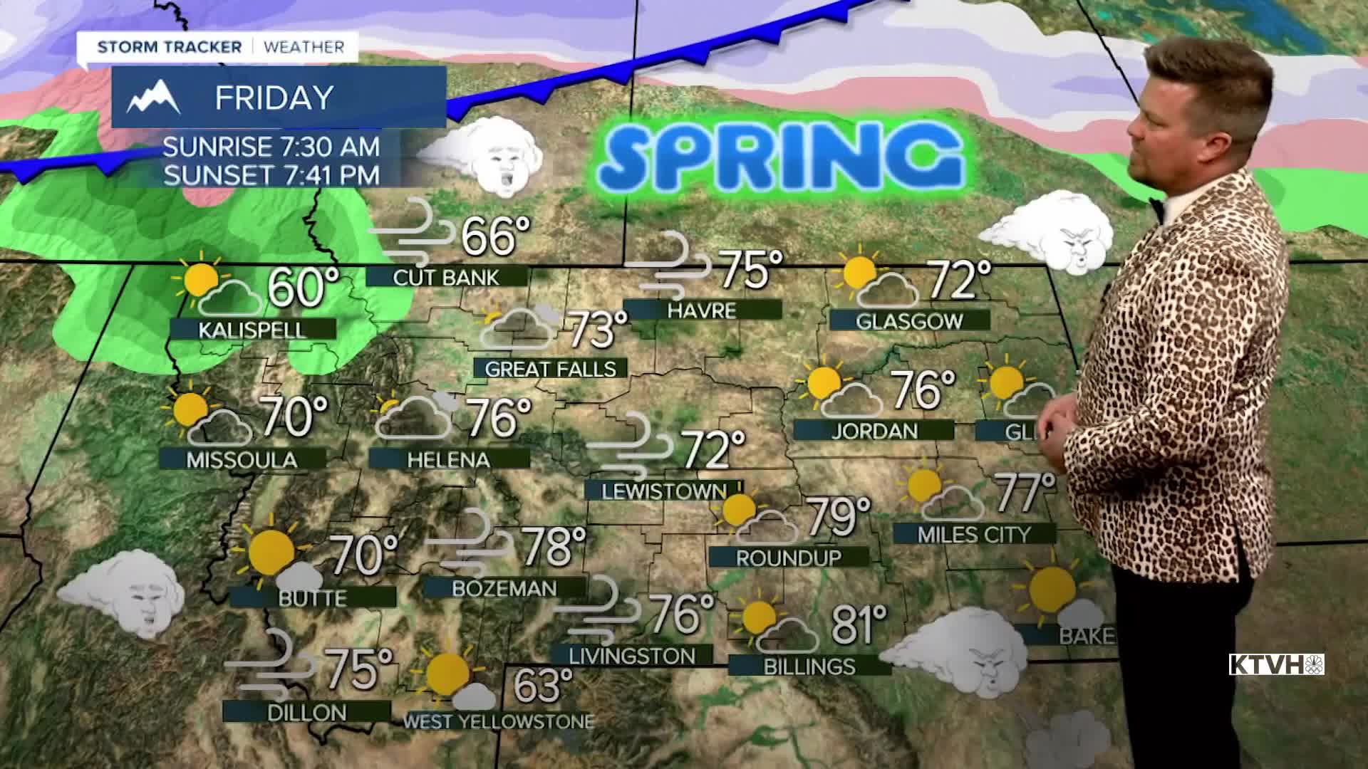
Friday is the first official day of Spring even though it's felt like it for a while. Warm temperatures this week will get even warmer by Friday with a few record highs likely. One or two towns in southern Montana could even hit 80 on Friday. There have been a few wildfires with the warmth, wind and dried grass that has not greened up yet. Please use caution. Thursday will be a warm and windy day for most of the state. Unfortunately, the skies will likely stay mostly cloudy. Some areas in southwest and northeast Montana will have partly cloudy skies. Highs will top out in the 60s and 70s with a few records possible. Spring officially begins on Friday, and the first day of the new season will be partly to mostly cloudy with highs in the 60s and 70s. The wind will once again be strong for most of the state. The next cold front will come through Montana on Saturday with showers in the lower elevations and a return of some light snow to the mountains. Highs will cool into the 40s and 50s. Sunday will be mostly sunny with lighter wind and highs in the 40s and 50s. The next significant storm will come Wednesday with a lot of wind, colder temperatures, a burst of rain and snow, and a return of snow to the mountains.
Have a nice day,
Curtis Grevenitz
Chief Meteorologist
