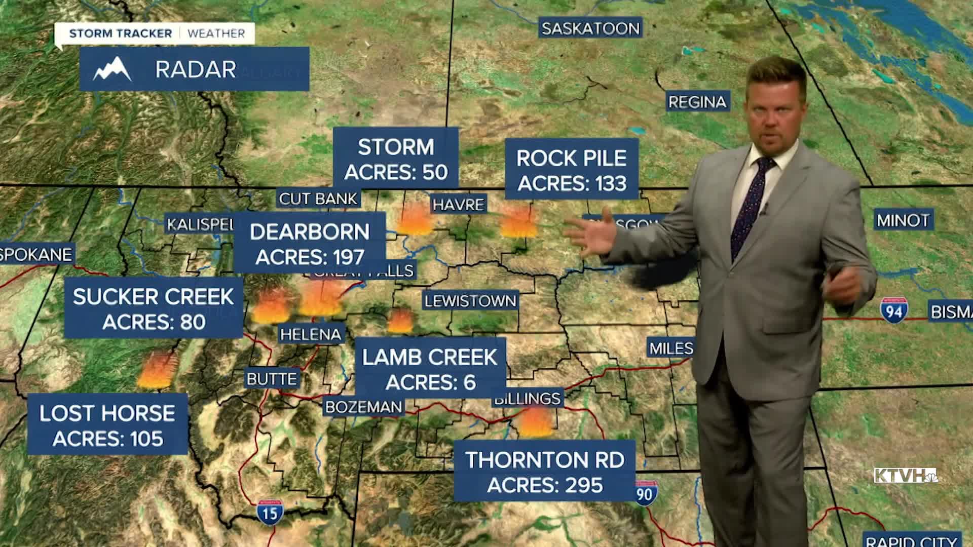


Thunderstorms have been wild and wet across the state the last several days, but lightning strikes have sparked moderate sized wildfires across the state as well. Most of these fires are between several acres up to a few hundred acres. Even though the storms are producing rain, wildfires have started. Strong to severe thunderstorms have hit the state hard over the last few days and will continue to hit the state over the next several days with more heavy rain, large hail, strong wind and lightning strikes that could spark new fires. Wednesday will have more isolated thunderstorms especially across western Montana. The northern part of the state will be dry. High temperatures will again be below normal in the 70s and 80s. More numerous thunderstorms are likely on Thursday. Severe thunderstorms are possible again with large hail and damaging wind. Highs will top out in the 70s and 80s. Friday will be another active day with widespread thunderstorms. Storms will continue both Saturday and Sunday afternoons. Storm activity may quiet down with some warmer temperatures for the beginning of next week.
Have a great day,
Curtis Grevenitz
Chief Meteorologist
